

https://en.wikipedia.org/wiki/List_of_national_parks_of_the_United_States
이 중에서 몇 곳이나 가보셨나요?
많이 갔다라고 생각했는데, 63곳 중에 28곳을 방문했군요.
| Name | Image | Location | Date established as park[7][12] | Area (2021)[13] | Recreation visitors (2021)[11] | Description |
|---|---|---|---|---|---|---|
| Acadia |  |
Maine 44.35°N 68.21°W |
February 26, 1919 | 49,071.40 acres (198.6 km2) | 4,069,098 | Covering most of Mount Desert Island and other coastal islands, Acadia features the tallest mountain on the Atlantic coast of the United States, granite peaks, ocean shoreline, woodlands, and lakes. There are freshwater, estuary, forest, and intertidal habitats.[14][15] |
| American Samoa |  |
American Samoa 14.25°S 170.68°W |
October 31, 1988 | 8,256.67 acres (33.4 km2) | 8,495 | The southernmost national park is on three Samoan islands in the South Pacific. It protects coral reefs, rainforests, volcanic mountains, and white beaches. The area is also home to flying foxes, brown boobies, sea turtles, and 900 species of fish.[16] |
| Arches | .jpg) |
Utah 38.68°N 109.57°W |
November 12, 1971 | 76,678.98 acres (310.3 km2) | 1,806,865 | This site features more than 2,000 natural sandstone arches, with some of the most popular arches in the park being Delicate Arch, Landscape Arch and Double Arch.[17] Millions of years of erosion have created these structures in a desert climate where the arid ground has life-sustaining biological soil crusts and potholes that serve as natural water-collecting basins. Other geologic formations include stone pinnacles, fins, and balancing rocks.[18] |
| Badlands |  |
South Dakota 43.75°N 102.50°W |
November 10, 1978 | 242,755.94 acres (982.4 km2) | 1,224,226 | The Badlands are a collection of buttes, pinnacles, spires, and mixed-grass prairies within the drainage basin of the White River, in southwestern South Dakota. They contain the largest known assemblage of late Eocene and Oligocene mammal fossils.[19] Wildlife includes bison, bighorn sheep, black-footed ferrets, and prairie dogs.[20] |
| Big Bend |
.jpg) |
Texas 29.25°N 103.25°W |
June 12, 1944 | 801,163.21 acres (3,242.2 km2) | 581,220 | Named for the prominent bend in the Rio Grande along the U.S.–Mexico border, this park encompasses a large and remote part of the Chihuahuan Desert. Its main attraction is backcountry recreation in the arid Chisos Mountains and in canyons along the river. A wide variety of Cretaceous and Tertiary fossils as well as cultural artifacts of Native Americans also exist within its borders.[21] (BR)[22] |
| Biscayne |  |
Florida 25.65°N 80.08°W |
June 28, 1980 | 172,971.11 acres (700.0 km2) | 705,655 | The central part of Biscayne Bay, this mostly underwater park at the north end of the Florida Keys has four interrelated marine ecosystems: mangrove forest, the Bay, the Keys, and coral reefs. Threatened animals include the West Indian manatee, American crocodile, various sea turtles, and the peregrine falcon.[23] |
| Black Canyon of the Gunnison |  |
Colorado 38.57°N 107.72°W |
October 21, 1999 | 30,779.83 acres (124.6 km2) | 308,910 | The park protects a quarter of the Gunnison River, which slices sheer canyon walls from dark Precambrian-era rock. The canyon features some of the steepest cliffs and oldest rock in North America, and is a popular site for river rafting and rock climbing. The deep, narrow canyon is composed of gneiss and schist, which appears black when in shadow.[24] |
| Bryce Canyon |  |
Utah 37.57°N 112.18°W |
February 25, 1928 | 35,835.08 acres (145.0 km2) | 2,104,600 | Bryce Canyon is a geological amphitheater on southern Utah's Paunsaugunt Plateau with hundreds of tall, multicolored sandstone hoodoos formed by erosion. The region was originally settled by Native Americans and later by Mormon pioneers.[25] |
| Canyonlands | .jpg) |
Utah 38.2°N 109.93°W |
September 12, 1964 | 337,597.83 acres (1,366.2 km2) | 911,594 | This landscape was eroded into a maze of canyons, buttes, and mesas by the combined efforts of the Colorado River, Green River, and their tributaries, which divide the park into three districts. The park contains thousands of rock pinnacles and arches, as well as artifacts from Ancient Pueblo peoples.[26] |
| Capitol Reef |  |
Utah 38.20°N 111.17°W |
December 18, 1971 | 241,904.50 acres (979.0 km2) | 1,405,353 | The park's Waterpocket Fold is a 100-mile (160 km) monocline that exhibits the earth's diverse geologic layers. Other natural features include monoliths, eroded buttes, and sandstone domes, including one shaped like the United States Capitol.[27] |
| Carlsbad Caverns * |  |
New Mexico 32.17°N 104.44°W |
May 14, 1930 | 46,766.45 acres (189.3 km2) | 349,244 | Carlsbad Caverns has 117 caves, the longest of which is over 120 miles (190 km) long. The Big Room is almost 4,000 feet (1,200 m) long, and the caves are home to over 400,000 Mexican free-tailed bats and sixteen other species. Above ground are the Chihuahuan Desert and Rattlesnake Springs.[28] (WHS)[29] |
| Channel Islands |
 |
California 34.01°N 119.42°W |
March 5, 1980 | 249,561.00 acres (1,009.9 km2) | 319,252 | Five of the eight Channel Islands are protected, with half of the park's area underwater. The islands have a unique Mediterranean ecosystem originally settled by the Chumash people. They are home to over 2,000 species of land plants and animals, 145 endemic to them, including the island fox. Ferry services offer transportation to the islands from the mainland.[30] (BR)[31] |
| Congaree |
.jpg) |
South Carolina 33.78°N 80.78°W |
November 10, 2003 | 26,692.60 acres (108.0 km2) | 215,181 | On the Congaree River, this park is the largest portion of old-growth floodplain forest left in North America. Some of the trees are the tallest in the eastern United States. An elevated walkway called the Boardwalk Loop guides visitors through the swamp.[32] (BR)[33] |
| Crater Lake |  |
Oregon 42.94°N 122.1°W |
May 22, 1902 | 183,224.05 acres (741.5 km2) | 647,751 | Crater Lake lies in the caldera of an ancient volcano called Mount Mazama that collapsed 7,700 years ago. The lake is the deepest in the United States and is noted for its vivid blue color and water clarity. Wizard Island and the Phantom Ship are more recent volcanic formations within the caldera. As the lake has no inlets or outlets, it is replenished only by precipitation.[34] |
| Cuyahoga Valley |  |
Ohio 41.24°N 81.55°W |
October 11, 2000 | 32,571.88 acres (131.8 km2) | 2,575,275 | This park along the Cuyahoga River has waterfalls, hills, trails, and exhibits on early rural living. The Ohio and Erie Canal Towpath Trail follows the Ohio and Erie Canal, where mules towed canal boats. The park has numerous historic homes, bridges, and structures,[35] and also offers a scenic train ride.[36] |
| Death Valley |
 |
California, Nevada 36.24°N 116.82°W |
October 31, 1994 | 3,408,395.63 acres (13,793.3 km2) | 1,146,551 | Death Valley is the hottest, lowest, and driest place in the United States, with daytime temperatures that have exceeded 130 °F (54 °C). The park protects Badwater Basin and its vast salt flats at the lowest elevation in North America, −282 ft (−86 m),[37] This geologic graben also protects numerous canyons, badlands, sand dunes, mountain ranges, historic mines, springs, and more than 1,000 species of plants that grow.[38] (BR)[39] |
| Denali |
 |
Alaska 63.33°N 150.50°W |
February 26, 1917 | 4,740,911.16 acres (19,185.8 km2) | 229,521 | Centered on Denali, the tallest and most prominent mountain in North America, the park is serviced by a single road leading to Wonder Lake, most of which can only be accessed via scheduled tour buses. Denali and other peaks of the Alaska Range are covered with long glaciers and boreal forest. Wildlife includes grizzly bears, Dall sheep, moose, caribou, and wolves.[40] (BR)[41] |
| Dry Tortugas |
 |
Florida 24.63°N 82.87°W |
October 26, 1992 | 64,701.22 acres (261.8 km2) | 83,817 | The islands of the Dry Tortugas, at the westernmost end of the Florida Keys, are the site of Fort Jefferson, a Civil War-era fort that is the largest masonry structure in the Western Hemisphere. The park is home to undisturbed coral reefs and shipwrecks, and is only accessible by plane or boat.[42] (BR)[43] |
| Everglades |
_NPSPhoto,_Sarah_Zenner_(9255147763).jpg) |
Florida 25.32°N 80.93°W |
May 30, 1934 | 1,508,938.57 acres (6,106.5 km2) | 942,130 | The Everglades are the largest tropical wilderness in the United States. This mangrove and tropical rainforest ecosystem and marine estuary is home to 36 protected species, including the Florida panther, American crocodile, and West Indian manatee. Some areas have been drained and developed; restoration projects aim to restore the ecology.[44] (WHS)[45] (BR)[43] |
| Gates of the Arctic | .jpg) |
Alaska 67.78°N 153.30°W |
December 2, 1980 | 7,523,897.45 acres (30,448.1 km2) | 7,362 | The country's northernmost park protects an expanse of pure wilderness in Alaska's Brooks Range and has no park facilities. The land is home to Alaska Natives who have relied on the land and caribou for 11,000 years.[46] |
| Gateway Arch |  |
Missouri 38.63°N 90.19°W |
February 22, 2018[47] | 91 acres (0.4 km2) | 1,145,081 | The Gateway Arch is a 630-foot (192 m) (both high and wide) catenary arch built in the 1960s to commemorate the Lewis and Clark Expedition, initiated by Thomas Jefferson, and the subsequent westward expansion of the country. The nearby Old Courthouse, across a greenway to the west of the arch, was the original site of the landmark Dred Scott case about slavery. An underground museum describes the arch's construction and the country's westward expansion.[48] |
| Glacier |
 |
Montana 48.80°N 114.00°W |
May 11, 1910 | 1,013,126.39 acres (4,100.0 km2) | 3,081,656 | The U.S. half of Waterton-Glacier International Peace Park, this park includes 26 rapidly receding glaciers and 130 named lakes surrounded by Rocky Mountain peaks. Historic hotels and the landmark Going-to-the-Sun Road accommodate visitors.[49] The local mountains, formed by an overthrust, expose Paleozoic fossils including trilobites, mollusks, giant ferns and dinosaurs. The park is also home to Triple Divide Peak, which forms the boundary between the watersheds of the Atlantic, Pacific, and Arctic Oceans.[50] (WHS)[51] (BR)[52] |
| Glacier Bay |
 |
Alaska 58.50°N 137.00°W |
December 2, 1980 | 3,223,383.43 acres (13,044.6 km2) | 89,768 | Glacier Bay contains tidewater glaciers, mountains, fjords, and a temperate rainforest, and is home to large populations of grizzly bears, mountain goats, whales, seals, and eagles. When discovered in 1794 by George Vancouver, the entire bay was covered by ice, but the glaciers have since receded more than 65 miles (105 km).[53] (WHS)[54] (BR)[55] |
| Grand Canyon * |  |
Arizona 36.06°N 112.14°W |
February 26, 1919 | 1,201,647.03 acres (4,862.9 km2) | 4,532,677 | The Grand Canyon, carved by the mighty Colorado River, is 277 miles (446 km) long, up to 1 mile (1.6 km) deep, and up to 15 miles (24 km) wide. Millions of years of erosion have resulted in a massive three-tiered canyon, exposing the multicolored layers of the Colorado Plateau in mesas and canyon walls, visible from trails that descend into the canyon from the north and south rims.[56] (WHS)[57] |
| Grand Teton |
 |
Wyoming 43.73°N 110.80°W |
February 26, 1929 | 310,044.36 acres (1,254.7 km2) | 3,885,230 | Grand Teton is the tallest mountain in the scenic Teton Range. The park's historic Jackson Hole and reflective piedmont lakes teem with endemic wildlife, with a backdrop of craggy mountains that rise abruptly from the sage-covered valley below.[58] (BR)[6] |
| Great Basin |  |
Nevada 38.98°N 114.30°W |
October 27, 1986 | 77,180.00 acres (312.3 km2) | 144,875 | Based around Nevada's second tallest mountain, Wheeler Peak, Great Basin National Park protects 5,000-year-old bristlecone pines, a rock glacier, and the limestone Lehman Caves. Due to its remote location, the park is home to some of the country's darkest night skies. Wildlife includes the Townsend's big-eared bat, pronghorn, and Bonneville cutthroat trout.[59] |
| Great Sand Dunes | .jpg) |
Colorado 37.73°N 105.51°W |
September 24, 2004 | 107,345.73 acres (434.4 km2) | 602,613 | The tallest sand dunes in North America, up to 750 feet (230 m) tall, were formed by deposits of the ancient Rio Grande in the San Luis Valley. Abutting a variety of grasslands, shrublands, and wetlands, the park also features alpine lakes, six 13,000-foot mountains, and old-growth forests.[60] |
| Great Smoky Mountains |
.jpg) |
North Carolina, Tennessee 35.68°N 83.53°W |
June 15, 1934 | 522,426.88 acres (2,114.2 km2) | 14,161,548 | The Great Smoky Mountains, part of the Appalachian Mountains, span a wide range of elevations, making them home to over 400 vertebrate species, 100 tree species, and 5,000 plant species. Hiking is the park's main attraction, with over 800 miles (1,300 km) of trails, including 70 miles (110 km) of the Appalachian Trail. Other activities include fishing, horseback riding, and touring nearly 80 historic structures.[61] (WHS)[62] (BR)[63] |
| Guadalupe Mountains |  |
Texas 31.92°N 104.87°W |
October 15, 1966 | 86,367.10 acres (349.5 km2) | 243,291 | This park contains Guadalupe Peak, the highest point in Texas, as well as the scenic McKittrick Canyon filled with bigtooth maples, a corner of the arid Chihuahuan Desert, and a fossilized coral reef from the Permian era.[64] |
| Haleakalā |
 |
Hawaii 20.72°N 156.17°W |
July 1, 1961 | 33,264.62 acres (134.6 km2) | 853,181 | The Haleakalā volcano on Maui features a very large crater with numerous cinder cones, a grove of non-native trees, the Kipahulu section's scenic pools of freshwater fish, and the endemic Hawaiian goose. The park protects the greatest number of endangered species within a U.S. national park.[65] (BR)[66] |
| Hawaiʻi Volcanoes |
 |
Hawaii 19.38°N 155.20°W |
August 1, 1916 | 325,605.28 acres (1,317.7 km2) | 1,262,747 | This park on the Big Island protects the Kīlauea and Mauna Loa volcanoes, two of the world's most active geological features. Diverse ecosystems range from tropical forests at sea level to barren lava beds at more than 13,000 feet (4,000 m).[67] (WHS)[68] (BR)[66] |
| Hot Springs |  |
Arkansas 34.51°N 93.05°W |
March 4, 1921 | 5,554.15 acres (22.5 km2) | 2,162,884 | Hot Springs was originally established by Congress as a federal reserve on April 20, 1832, making it the oldest area managed by the National Park Service. Natural thermal springs flow out of the Ouachita Mountains, providing opportunities for relaxation in a historic setting. Bathhouse Row preserves examples of 19th-century architecture.[69] Hot Springs is the first national park within a city and was the smallest national park until 2018.[70] |
| Indiana Dunes |  |
Indiana 41.6533°N 87.0524°W |
February 15, 2019 | 15,349.08 acres (62.1 km2) | 3,177,210 | Previously designated a national lakeshore, parts of this 20-mile (32 km) stretch of the southern shore of Lake Michigan have sandy beaches and tall dunes. The park includes grassy prairies, peat bogs, and marsh wetlands home to over 2,000 species.[71] |
| Isle Royale |
 |
Michigan 48.10°N 88.55°W |
April 3, 1940 | 571,790.30 acres (2,314.0 km2) | 25,844 | The largest island in Lake Superior is a place of isolation and wilderness. Along with its many shipwrecks, waterways, and hiking trails, the park also includes over 400 smaller islands within 4.5 miles (7.2 km) of its shores. There are only 20 mammal species on the island, though the relationship between its wolf and moose populations is especially unique.[72] (BR)[73] |
| Joshua Tree |
 |
California 33.79°N 115.90°W |
October 31, 1994 | 795,155.85 acres (3,217.9 km2) | 3,064,400 | Covering large areas of the Colorado and Mojave Deserts and the Little San Bernardino Mountains, this desert landscape is populated by vast stands of Joshua trees. Large changes in elevation reveal various contrasting environments including bleached sand dunes, dry lakes, rugged mountains, and maze-like clusters of monzogranite monoliths.[74] (BR)[39] |
| Katmai |  |
Alaska 58.50°N 155.00°W |
December 2, 1980 | 3,674,529.33 acres (14,870.3 km2) | 24,764 | This park on the Alaska Peninsula protects the Valley of Ten Thousand Smokes, an ash flow formed by the 1912 eruption of Novarupta, and the stratovolcano Mount Katmai. Over 2,000 grizzly bears come here each year to catch spawning salmon. Other wildlife includes caribou, wolves, moose, and wolverines.[75] |
| Kenai Fjords |  |
Alaska 59.92°N 149.65°W |
December 2, 1980 | 669,650.05 acres (2,710.0 km2) | 411,782 | Near Seward on the Kenai Peninsula, this park protects the Harding Icefield and at least 38 glaciers and fjords stemming from it. The only area accessible to the public by road is the rapidly shrinking Exit Glacier. Boat and kayak tours offer views of tidewater glaciers, whales, sea lions, and marine birds.[76] |
| Kings Canyon |
 |
California 36.80°N 118.55°W |
March 4, 1940 | 461,901.20 acres (1,869.2 km2) | 562,918 | Home to several giant sequoia groves and the General Grant Tree, the world's second largest measured tree, this park also features part of the Kings River, sculptor of the dramatic granite canyon that is its namesake, and the San Joaquin River, as well as Boyden Cave.[77] Although Kings Canyon National Park was designated as such in 1940, it subsumed General Grant National Park, which had been established on October 1, 1890, as the United States' fourth national park.[78][79][80] (BR)[81] |
| Kobuk Valley | .jpg) |
Alaska 67.55°N 159.28°W |
December 2, 1980 | 1,750,716.16 acres (7,084.9 km2) | 11,540 | Kobuk Valley protects 61 miles (98 km) of the Kobuk River and three regions of sand dunes. Created by glaciers, the Great Kobuk, Little Kobuk, and Hunt River Sand Dunes can reach 100 feet (30 m) high and 100 °F (38 °C), and they are the largest dunes in the Arctic. Twice a year, half a million caribou migrate through the dunes and across river bluffs that expose well-preserved ice age fossils.[82] |
| Lake Clark | .jpg) |
Alaska 60.97°N 153.42°W |
December 2, 1980 | 2,619,816.49 acres (10,602.0 km2) | 18,278 | The region around Lake Clark features four active volcanoes, including Mount Redoubt, as well as an abundance of rivers, glaciers, and waterfalls. Temperate rainforests, a tundra plateau, and three mountain ranges complete the landscape.[83] |
| Lassen Volcanic |  |
California 40.49°N 121.51°W |
August 9, 1916 | 106,589.02 acres (431.4 km2) | 359,635 | Lassen Peak, the largest lava dome volcano in the world, is joined by all three other types of volcanoes in this park: shield, cinder cone, and composite. Though Lassen itself last erupted in 1915, most of the rest of the park is continuously active. Numerous hydrothermal features, including fumaroles, boiling pools, and bubbling mud pots, are heated by molten rock from beneath the peak.[84] |
| Mammoth Cave |
 |
Kentucky 37.18°N 86.10°W |
July 1, 1941 | 54,016.29 acres (218.6 km2) | 515,774 | With more than 400 miles (640 km) of passageways explored, Mammoth Cave is the world's longest known cave system. Subterranean wildlife includes eight bat species, Kentucky cave shrimp, Northern cavefish, and cave salamanders. Above ground, the park provides recreation on the Green River, 70 miles of hiking trails, and plenty of sinkholes and springs.[85] (WHS)[86] (BR)[87] |
| Mesa Verde * |  |
Colorado 37.18°N 108.49°W |
June 29, 1906 | 52,485.17 acres (212.4 km2) | 548,477 | This area constitutes over 4,000 archaeological sites of the Ancestral Puebloan people, who lived here and elsewhere in the Four Corners region for at least 700 years. Cliff dwellings built in the 12th and 13th centuries include Cliff Palace, which has 150 rooms and 23 kivas, and the Balcony House, with its many passages and tunnels.[88] (WHS)[89] |
| Mount Rainier |  |
Washington 46.85°N 121.75°W |
March 2, 1899 | 236,381.64 acres (956.6 km2) | 1,670,063 | Mount Rainier, an active stratovolcano, is the most prominent peak in the Cascades and is covered by 26 named glaciers including Carbon Glacier and Emmons Glacier, the longest and largest in the contiguous United States respectively. The mountain is popular for climbing, and more than half of the park is covered by subalpine and alpine forests and meadows seasonally in bloom with wildflowers. Paradise on the south slope is among the snowiest places on Earth.[90] The Longmire visitor center is the start of the Wonderland Trail, which encircles the mountain.[91] |
| New River Gorge |  |
West Virginia 38.07°N 81.08°W |
December 27, 2020 | 7,021 acres (28.4 km2)[92] | 1,682,720 | The New River Gorge is the deepest river gorge east of the Mississippi River. The park primarily covers the lower gorge area around the New River Gorge Bridge, which features some of the country's best whitewater rafting. Smaller noncontiguous sections showcase the ghost town of Thurmond, the scenic Grandview vista, and Sandstone Falls. The other 65,165 acres (263.71 km2) of the redesignated national river is now a national preserve, spanning 53 mi (85 km) of the New River.[93][94] |
| North Cascades |  |
Washington 48.70°N 121.20°W |
October 2, 1968 | 504,780.94 acres (2,042.8 km2) | 17,855 | The highly glaciated mountains of the North Cascades Range exhibit a spectacular and complex geologic history. Between the river valleys and high peaks there are eight diverse life zones with 75 mammal and 1,600 vascular plant species. Popular hiking and climbing areas of the Stephen Mather Wilderness include Cascade Pass, Mount Shuksan, Mount Triumph, and Eldorado Peak. Ross Lake and Lake Chelan National Recreation Areas adjoin the two segments of the park and are all administered together.[95] |
| Olympic |
 |
Washington 47.97°N 123.50°W |
June 29, 1938 | 922,649.41 acres (3,733.8 km2) | 2,718,925 | This park on the Olympic Peninsula includes a wide range of ecosystems from Pacific shoreline to temperate rainforests to the glaciated alpine peaks of the Olympic Mountains, the tallest of which is Mount Olympus. The Hoh and Quinault Rainforests are the wettest areas in the contiguous United States, with the Hoh receiving an average of almost 12 ft (3.7 m) of rain every year.[96][97] (WHS)[98] (BR)[99] |
| Petrified Forest |  |
Arizona 35.07°N 109.78°W |
December 9, 1962 | 221,390.21 acres (895.9 km2) | 590,334 | This portion of the Chinle Formation has a large concentration of 225-million-year-old petrified wood. The surrounding Painted Desert features eroded cliffs of red-hued volcanic rock called bentonite. Dinosaur fossils and over 350 Native American sites are also protected in this park.[100] |
| Pinnacles |  |
California 36.48°N 121.16°W |
January 10, 2013 | 26,685.73 acres (108.0 km2) | 348,857 | Named for the eroded leftovers of a portion of an extinct volcano, the park's massive black and gold monoliths of andesite and rhyolite are a popular destination for rock climbers. Hikers have access to trails crossing the Coast Range wilderness. The park is one of the few locations where the endangered California condor can be seen in the wild. Pinnacles also supports a dense population of prairie falcons and more than 13 species of bat that populate its talus caves.[101] |
| Redwood * |  |
California 41.30°N 124.00°W |
October 2, 1968 | 138,999.37 acres (562.5 km2) | 435,879 | This park and the co-managed state parks protect almost half of all remaining coastal redwoods, the tallest trees on earth. There are three large river systems in this very seismically active area, and 37 miles (60 km) of protected coastline reveal tide pools and seastacks. The prairie, estuary, coast, river, and forest ecosystems contain a wide variety of animal and plant species.[102] (WHS)[103] |
| Rocky Mountain |
 |
Colorado 40.40°N 105.58°W |
January 26, 1915 | 265,807.24 acres (1,075.7 km2) | 4,434,848 | Bisected north to south by the Continental Divide, this portion of the Rockies has ecosystems varying from over 150 riparian lakes to montane and subalpine forests to treeless alpine tundra. Wildlife including elk, moose, mule deer, bighorn sheep, black bears, and cougars inhabit its igneous mountains and glacial valleys. Longs Peak, a classic Colorado fourteener, and the scenic Bear Lake are popular destinations, as well as the historic Trail Ridge Road, which reaches an elevation of more than 12,000 feet (3,700 m).[104] (BR)[105] |
| Saguaro |  |
Arizona 32.25°N 110.50°W |
October 14, 1994 | 92,867.42 acres (375.8 km2) | 1,079,786 | Split into the separate Rincon Mountain and Tucson Mountain districts, this park is evidence that the dry Sonoran Desert is still home to a great variety of life spanning six biotic communities. Beyond the namesake giant saguaro cacti, there are barrel cacti, chollas, and prickly pears, as well as lesser long-nosed bats, spotted owls, and javelinas.[106] |
| Sequoia |
 |
California 36.43°N 118.68°W |
September 25, 1890 | 404,062.63 acres (1,635.2 km2) | 1,059,548 | This park protects the Giant Forest, which boasts some of the world's largest trees, the General Sherman being the largest measured tree in the park. Other features include over 240 caves, a long segment of the Sierra Nevada including the tallest mountain in the contiguous United States, and Moro Rock, a large granite dome.[107] (BR)[81] |
| Shenandoah | .jpg) |
Virginia 38.53°N 78.35°W |
December 26, 1935 | 200,192.09 acres (810.1 km2) | 1,592,312 | Shenandoah's Blue Ridge Mountains are covered by hardwood forests that teem with a wide variety of wildlife. The Skyline Drive and Appalachian Trail run the entire length of this narrow park, along with more than 500 miles (800 km) of hiking trails passing scenic overlooks and cataracts of the Shenandoah River.[108] |
| Theodore Roosevelt |  |
North Dakota 46.97°N 103.45°W |
November 10, 1978 | 70,446.89 acres (285.1 km2) | 796,085 | This region that enticed and influenced President Theodore Roosevelt consists of a park of three units in the northern badlands. Besides Roosevelt's historic cabin, there are numerous scenic drives and backcountry hiking opportunities. Wildlife includes American bison, pronghorn, bighorn sheep, and wild horses.[109] |
| Virgin Islands |  |
U.S. Virgin Islands 18.33°N 64.73°W |
August 2, 1956 | 15,052.33 acres (60.9 km2) | 323,999 | This island park on Saint John preserves pristine beaches surrounded by mangrove forests, seagrass beds, and coral reefs. It also has Taíno archaeological sites and the ruins of sugar plantations from Columbus's time.[110] |
| Voyageurs |  |
Minnesota 48.50°N 92.88°W |
April 8, 1975 | 218,222.35 acres (883.1 km2) | 243,042 | This park protecting four lakes near the Canada–US border is a site for canoeing, kayaking, and fishing. The park also preserves a history populated by Ojibwe Native Americans, French fur traders called voyageurs, and gold miners. Formed by glaciers, the region features tall bluffs, rock gardens, islands, bays, and several historic buildings.[111] |
| White Sands |  |
New Mexico 32.78°N 106.17°W |
December 20, 2019[112] | 146,344.31 acres (592.2 km2) | 782,469 | Located in the mountain-ringed Tularosa Basin, White Sands consists of the southern part of a 275-square-mile (710 km2) field of white sand dunes composed of gypsum crystals—the world's largest gypsum dunefield. The park is completely within the White Sands Missile Range and is subject to closure when tests are conducted.[113] |
| Wind Cave |  |
South Dakota 43.57°N 103.48°W |
January 9, 1903 | 33,970.84 acres (137.5 km2) | 709,001 | Wind Cave is distinctive for its calcite fin formations called boxwork, a unique formation rarely found elsewhere, and needle-like growths called frostwork. It is one of the longest caves in the world and creates a wind as air pressure changes. Above ground is a mixed-grass prairie with animals such as bison, black-footed ferrets, and prairie dogs and ponderosa pine forests home to cougars and elk.[114] The cave is culturally significant to the Lakota people as a creation site.[115] |
| Wrangell–St. Elias * |  |
Alaska 61.00°N 142.00°W |
December 2, 1980 | 8,323,146.48 acres (33,682.6 km2) | 50,189 | The largest national park in the system protects the convergence of the Alaska, Chugach, Wrangell, and Saint Elias Ranges, which include many of the continent's tallest mountains and volcanoes, including the 18,008-foot Mount Saint Elias. More than a quarter of the park is covered with glaciers, including the tidewater Hubbard Glacier, piedmont Malaspina Glacier, and valley Nabesna Glacier.[116] (WHS)[54] |
| Yellowstone |
 |
Wyoming, Montana, Idaho 44.60°N 110.50°W |
March 1, 1872 | 2,219,790.71 acres (8,983.2 km2) | 4,860,242 | Situated on the Yellowstone Caldera, the park has an expansive network of geothermal areas including boiling mud pots, vividly colored hot springs such as Grand Prismatic Spring, and regularly erupting geysers, the best-known being Old Faithful. The yellow-hued Grand Canyon of the Yellowstone River contains several high waterfalls, and four mountain ranges traverse the park. More than 60 mammal species including timber wolves, grizzly bears, black bears, lynxes, bison, and elk make this park one of the best wildlife viewing spots in the country.[117] (WHS)[118] (BR)[119] |
| Yosemite * |  |
California 37.83°N 119.50°W |
October 1, 1890 | 761,747.50 acres (3,082.7 km2) | 3,287,595 | Yosemite features sheer granite cliffs, exceptionally tall waterfalls, and old-growth forests at a unique intersection of geology and hydrology. Half Dome and El Capitan rise from the park's centerpiece, the glacier-carved Yosemite Valley, and from its vertical walls drop Yosemite Falls, one of North America's tallest waterfalls at 2,425 feet (739 m) high. Three giant sequoia groves, along with a pristine wilderness in the heart of the Sierra Nevada, are home to a wide variety of rare plant and animal species.[120] (WHS)[121] |
| Zion |  |
Utah 37.30°N 113.05°W |
November 19, 1919 | 147,242.66 acres (595.9 km2) | 5,039,835 | Located at the junction of the Colorado Plateau, Great Basin, and Mojave Desert, this park contains sandstone features such as mesas, rock towers, and canyons, including the Virgin River Narrows. The various sandstone formations and the forks of the Virgin River create a wilderness divided into four ecosystems: desert, riparian, woodland, and coniferous forest.[122] |
오 저는 26곳을 방문해 보았네요. 아직 가볼 만한 곳이 아주 많음을 보고 놀랍니다.
캘리포니아와 알래스카에 많이 있더라고요.
많이 모여있는 주는 그곳에 살지 않고서는 다 방문하기는 쉽지 않을 것 같다는 생각이 들었습니다.
전 딱 12곳이네요. 좀 분발해야겠습니다. ^^
전 21곳이요. 열심히 도장찍기 한다고 했는데 반도 못가봤네요. 올해 작은애가 4학년이라,, 리스트 감사히 쓰겠습니다ㅎㅎ
저도 이제 12곳 밖에 못갔네요. 캘리포니아에 사는데도요..
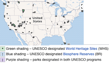
좋은 자료 공유 감사합니다. 색깔이 다른 게 궁금해서 가보니 유네스코 등재 표시였군요. 작년방문자수 1-3등은 Great Smoky Mountains (1.4천만명!), Zion (5백만명), Yellowstone (4.8백만명)이네요. 그랜드캐년 요세미티같은덴 이미 다들 가봐서 예전만큼 방문자 수가 안나오나봐요.
캘리포냐 9개, 유타 5개, 콜로라도 4개, 애리조나 3개니 리스트 3분의 1이 저 네 주에 몰빵이군요.
그랜드 캐년, 요세미티, 옐로스톤은 접근성이 떨어지는 것이 이유가 아닐까 싶습니다.
그에 비해 자이언은 공원 입구까지 호텔들이 즐비하고 인터스테이트 하이웨이에서도 별로 안 멀죠.
그레이트 스모키 마운틴즈도 녹스빌에서는 아주 가깝고, 샬롯에서 당일에 다녀올 거리이네요.
좀 한적한 동네가 잘 보전이 되어서 국립공원이 된 것이 아닌가 하는 생각이 듭니다.
저도 베이에어리어서 가까운 요세미티 방문자수가 적어서 놀랐었는데 생각해보니 pandemic 이후로 요세미티는 예약제로 바뀌어 하루에 입장할 수 있는 인원을 제한하는게 큰 이유 일 것 같습니다. 실제로 예전에는 요세미티 밸리 혹은 글래셔 포인트에서 차도 엄청 막히고 주차도 힘들었는데 예약제로 바뀐 이후로는 확실히 인원이 줄어든것 같아요.
한군데 가봤어요
우리집 뒷마당이랑 연결된곳 ㅎㅎ
와 28/63 이면 많이 다니셨네요 !! 혹시 그중에 가장 좋았던 곳이 어디였는지 궁금합니다. 저희는 Olympic, Mt Rainier, North Cascades 이 세곳만 돌아가며 매주 드나들기도 바쁩니다. 앞으로 좀더 활동반경을 넓히려 했는데 좋은 자료 공유 감사드립니다.
딱 한 곳만 고르기는 쉽지가 않은데요.
아무래도 한 곳만 간다고 하면 옐로 스톤을 골라야 될 것 같습니다.
말씀하신 워싱턴 주의 국립공원 3곳은 버킷 리스트에는 항상 있는데, 실행은 못하고 있네요.
일단 시기도 잘 맞아 떨어져야 하고, 시간도 충분해야 하고요.
시애틀 인근에 베이스 캠프를 일주일 차리고 하나씩 다녀와야 할 것 같아요.
일단 미국 전체에서 가본 주가 몇개 안됩.... 쿨럭...
16군데.. 내년 이맘때면 4군데 추가예정이네요.
차로 4시간정도 거리의 근처 살면서 안간 곳도 두군데나 있네요..
미드웨스트나 동부지역 국립공원 중에는 state park 수준의 애매한곳들도 많아서....
스모키마운틴이 매년 방문자수 부동의 1위인 이유는.. 서부지역과 달리 근처에 달리 갈만한 국립공원이 없어서 그런것이 아닐까 싶어요.
딱 한군데 가봤네요. 사는 오하이오주에도 국립공원 있다는 걸 오늘 알았습니다. 그리고 차로 갈만한 인디애나주에도 있네요. 일단 두곳 부터 가보고 싶네요. 덕분에 요긴한 정보 알아갑니다. 감사합니다.
23군데 다녀왔군요. 아이들이 커가면서 주말 액티비티가 한가득이니 대학보낼때까지는 숫자 늘리기는 쉬울것 같지 않습니다ㅠ
라이트닝님 이 좋은 샌디에고 사시면서 어딜 더 가시게요ㅎㅎ 전 14군데요.. 알래스카한번 찍어야겠어요.
근처는 자주 가는데도 또 가면 새로운 곳이 있긴 하더군요.
저도 첨에 미국 와서 부지런히 다닌다고 다녔는데 이제 겨우 서른 곳을 다녀왔네요. 좀 더 분발해야 겠습니다.
저는 22곳을 갔군요. 안가본 곳 중에 꼭 가보고 싶은 곳이 별로 없네요. Smoky Mtn, Glacier, Shenandoah 정도?
이번 여름에 Channel Islands에 갔으니 한 곳 더 추가입니다.
작은데는 아예 안 들어 있네요. 리스트 중에는 8군데 가 봤어요. 다음에 arcadia랑 yellowstone 가 보고 싶어요.
저희 동네 인근에 작은 내셔널 파크들 중 좋았던 곳이에요. 이 중 저는 Harpers Ferry 를 제일 좋아해요.
아니 저는 미국 Lower 48주를 다 차로 가면서 국립공원들 많이 갔다고 생각했는데, 정작 세어보니 19개 밖에 안 되네요!! 분발해야 겠어요!!
동부는 너무 없네요 ㅜㅠ
그러게요... 동부에 딱 두개라니... 너무 하는거 아닙니까?
가본 곳은 딱 동부에 있는 두개 뿐 이네요.
저 곳들 역시도 정말 운전 마아아아아아니 했던 기억 밖에 없네요.
다시봤더니 3군데... 다행히 세군데는 다 가봤군요. 역시 운전 마아아아아아아아아니 했던 기억 밖에...
16 곳에 가보았네요 그런데 같은 곳에 자꾸 또 가게 되네요
36곳 가봤습니다. 그 중에서 이게 왜 국립공원이야 하는 곳도 많았어요. 대신 주립공원도 좋은 곳이 많았구요. 제일 좋았던 곳을 꼽자면, 아무래도 아치스, 요세미티, 화이트샌드, 디날리 등이었던 것같아요.
+ Zion ^^
오오 감사합니다. 반대로 좀 실망스러웠던 곳은 어딘가요?
저도 공감해요 좋았던곳에 몇번씩 다시가게 되요. 개인적으로 별로 감흥이 없었던곳은 플로리다 에버글레이즈, 인다아나 듄, 미시간 슬리핑락이었어요. 사람들이 넘 많아서 그랬을수도 있어요.
저는 에버글레이즈는 모기 때문에 너무 힘들었는데, 악어를 보트타고 볼 수 있는 airboat 투어는 할만 했어요. 그래도 다시 가라고 하면 좀 멈칫할듯 하구요. 의외로 미국에서 가장 인기가 많다는 Great Smoky Mountains가 그냥 그랬어요. 낙엽이 한창일 때 갔어서 그나마 괜찮았는데, 그게 아니라면 실망을 많이 할 것 같아요. 근처에 지나가는 길이라 들렀던 국립공원 중에는 실망스러운 곳들이 많았어요. 기대가 없이 그냥 지나가는 길이니 한번 들러 보자는 제 태도의 문제였던 것 같기도 하구요. Congaree, Cuyahoga Valley가 대표적인 예인 것 같아요.
라이트닝님께서 이미 올리신 적이 있었군요. National park로 검색해서 안 나왔던거 같습니다. :)
양돌이님의 글은 한국어로 자세히 설명해주셔서 도움이 많이 되었습니다.
텍사스 빅밴 가보신분은 거의 없을거에요.. 오스틴에서 차몰고 10시간은 가야하고, 멕시코국경이라 경찰검문도 자주하고.. 그렇다고 그렌드케년만큼 웅장하지도 않고..
저는 가봤는데, 좋았어요.
말타고 멕시코 건너갔다 오는 사람도 보고, 배타고 건너는 국경도 보고요.
정작 검문은 안당해봤네요.
저는 가는 길에 미국 경찰에 스피딩으로 잡혔어요^^ 75마일 정도라 경고만 받고 보내줬는데, 주위에 아무 것도 없으니 생각없이 가다간 저처럼 잡힐 수 있어요. 저희는 3년 전 땡스기빙날에 갔었는데, 바람이 너무 많이 불어 힘들었어요. 와이프의 버켓리스트에 있는 곳이라 저에게는 선택의 여지가 없이 갔던 곳이지만, 또 가라면 힘들 것 같아요. 국립공원 자체는 좋았지만, 가까운 호텔이 4시간 정도 거리여서 당일로 많은 거리를 운전해야해서 쉽지 않았던 기억이 있어요.
숙박시설이 좀 멀긴 하더군요.
Fort Stockton에 괜찮은 숙박시설이 좀 있는데, 여긴 2시간 30분 정도입니다.
바람이 항상 부는 것은 아닌데, 심한 날은 심하더군요.
I-10이 황무지에 막아주는 지형이 없어서 그런 것 같더라고요.
역풍 불면 차가 속도가 안나고, 측풍 불면 차가 휘청거리고 그러더군요.
주위에 아무도 없는 곳에서는 크루즈 컨트롤로 제한 속도 주행이 안전하긴 하죠.
텍사스는 제한 속도도 높아서 제한 속도로 다녀도 괜찮다 싶었어요.
역풍 불때는 제한 속도로 다니는 것도 부담되서 좀 느리게 가기도 했네요.
경찰에 잡히고 나서야 크루즈 컨트롤로 바꿨었죠^^ 많은 미국인들이 죽기 전에 한번 가보고 싶은 국립공원인 만큼 웅장함은 확실히 있었죠. 날씨만 맞으면 괜찮았을텐데... 저희는 운이 없었죠^^
저는 킹스캐년 한군데 갔다왔습니다. 세콰이어도 같이 가려고 했었는데 화재로 못가게 닫아놔서 못갔습니다 ;;;
언젠가 63개 전부 한번쯤은 가보고 싶네요.
세콰이어 킹스캐년이 붙어있어서 함께 여행하기 딱 좋은데 화재때매 못 가셨다니 아쉽네요.
저도 킹스캐년의 Grant Grove 가서 General Grant Tree 보고 내려오는 길에 있는 캠핑장에서 캠핑했던 기억이 납니다.
네. 그래서 한번 더 가볼 생각입니다. 캠핑장은 어떠셨나요? 캠핑도 재밌겠네요
Montecito Lodge도 한번 검색해보세요. 국립공원 안에서 지낼 수 있는 아주 좋은 경험이 될거에요.
위치가 정말 돌아보기 좋을것 같네요. 추천 감사합니다.
그때 한국서 오신 부모님도 모시고 함께 서부지역 캠핑여행 했었는데 (캠핑장비는 중부에 사는 저희가 다 비행기로 실어가서요 ㅎㅎㅎ) 그 인근 국립공원들 여럿 돌며 캠핑여행 하는 와중에 가장 맘에들었던 캠핑장이었어요. 거대한 나무 숲 아래에서 캠핑하는 재미가 있더라고요. 캠핑장도 하나같이 다들 관리도 잘 되어있고 좋았습니다.
재밌으셨겠네요. 아직 장비도 없지만 언젠가 캠핑을 다녀보고 싶은 생각만 가득합니다 ㅎㅎ
지난달 오하이오에 있는 유적지가 유네스코문화 유산으로 선정되면서( https://www.milemoa.com/bbs/board/9022610 ), 미국의 전체 유네스코 문화유산도 찾아봤습다. 꽤 많은 유산이 국립공원과 겹치긴 합니다만, 국립공원과 더불어 가볼만한 곳으로 관심 가져도 좋을 것 같아 옮깁니다.
● Mesa Verde National Park, Colorado (1978)
● Yellowstone National Park, Wyoming, Montana & Idaho (1978)
● Everglades National Park, Florida (1979)
● Grand Canyon National Park, Arizona (1979)
● Independence Hall, Pennsylvania (1979)
● Kluane / Wrangell-St. Elias / Glacier Bay / Tatshenshini-Alsek, Alaska (1979)
● Redwood National and State Parks, California (1980)
● Mammoth Cave National Park, Kentucky (1981)
● Olympic National Park, Washington (1981)
● Cahokia Mounds State Historic Site, Illinois (1982)
● Great Smoky Mountains National Park, North Carolina & Tennessee (1983)
● La Fortaleza and San Juan National Historic Site in Puerto Rico, Puerto Rico (1983)
● Statue of Liberty, New York (1984)
● Yosemite National Park, California (1984)
● Chaco Culture, New Mexico (1987)
● Hawaii Volcanoes National Park, Hawaii (1987)
● Monticello and the University of Virginia in Charlottesville, Virginia (1987)
● Taos Pueblo, New Mexico (1992)
● Carlsbad Caverns National Park, New Mexico (1995)
● Waterton Glacier International Peace Park, Montana (1995)
● Papahānaumokuākea, Hawaii & United States Minor Outlying Islands (2010)
● Monumental Earthworks of Poverty Point, Louisiana (2014)
● San Antonio Missions, Texas (2015)
● The 20th-Century Architecture of Frank Lloyd Wright, Arizona, California, Illinois, New York, Pennsylvania & Wisconsin (2019)
● Hopewell Ceremonial Earthworks, Ohio (2023)
여긴 6곳을 가봤군요.
이번에 포함된 오하이오 유적 덕분에 저도 6곳을 찍었네요.
이 리스트에서는 안가본곳이 많네요.. 이중에서는 7군데 가봤습니다.
Mesa Verde NP, Yellowstone NP, Evergrades NP, Grand Canyon NP, Olympic NP, Statue of Liberty, Yosemite NP
저로선 7군데도 많이 가보셨다 싶은데요. 저는 63개 국립공원 중 가본 곳이 7곳이 안되네요. ㅠㅠ
저는 오하이오님 여행 컨셉 볼때마다 참 재미있습니다. 제가 가보지 못한 곳들이 너무 많아서요. 저는 그냥 국립공원 캠핑여행이 제 주요 여행 theme 이라서 말이죠 ㅎㅎㅎ 비행기로 캠핑장비 실어나르려고 항공사 카드들도 매년 연회비 내며 유지중이에요~ 가족이 다 같이 여행하면 비행기 한번 탑승할때 쓰는 무료 수화물 값어치만으로도 연회비보다는 높으니 말입니다 ㅎㅎㅎ
저야 잡히는대로 마구잡이라 컨셉이랄 것도 없는데 재밌게 봐주셔서 고맙습니다. 호텔 카드와 달리 항공사 카드는 보너스만 받고 연회비 3번째 내기 직전 취소하곤 했는데, JoshuaR 님처럼 장비를 실어야 한다면 항공사 카드 유지가 요긴하겠네요.

댓글 [53]