

잡곡님이 등떠밀어 주시고 기스님, 유자님, 비스트님이 바람 잡아 주시는 바람에 용기 내어 금요스페셜까지는 아니더라도 금요일에 정기적으로 글을 올려보려고 합니다. 기스님 따라 하기 이기도 하구요. 궁금하신 분들은 스크래치님의 금요스페셜 검색해 주세요.
기스님처럼 내공있는 주제를 올리기는 무리고 제가 썼던 여행 관련 후기 (먹거리나 호텔...주로 태국?)가 주 메뉴가 될듯 합니다. 기스님처럼 1년씩이나 올리기는 힘들고 밑천 떨어지면 조용히 사라지려구요...^^
여행 후기를 올릴 예정이니 첫 시작은 미국 국립공원 설문으로 시작해 보겠습니다. 나중에는 별볼일 없어져도 시작은 좀 거창하게 해야겠죠? ㅋㅋㅋ
헉!!!... 그런데 검색하다 보니 알미안님이 이미 작년에 선수를 치셨습니다.ㅠㅠ
하지만 알미안님이 올리신지 1년이 지났으니 괜찮아... 라고 혼자만 생각해 봅니다.^^
제가 게으르기도 하고 사람 붐비는 곳에 가는걸 별로 좋아하지 않아서 한국에 있을 때는 여행을 거의 다니지 않았습니다. 서울 촌놈인 셈이지요. 어쩌다 미국에 와서 지내다 보니 차몰고 여행 다니는 재미에 빠지게 되었어요. 그렇다고 정신없이 돌아다닌건 아니고 시간 날때마다 또는 부모님들 방문 하셨을때 장거리 여행을 하곤 했지요.
제 희망사항 중에 미국 국립공원 모두 돌아보기와 MLB 야구장 모두 돌아보기가 있습니다. 아마 쉽지 않은 일일듯 한데... 희망사항입니다.^^
오늘은 마적단 분들 어느 국립공원을 가보셨는지 설문 조사해볼까 합니다. 미국에 국립공원이 58군데나 59군데 정도 있다고 합니다. 이외에도 National Park Service에서 관리하고 있는 곳들이 많지만 여기서는 국립공원으로 한정지어 볼께요. 지금까지 제가 방문해본 국립공원은...
Crater Lake NP, OR (3)
Mount Reiner NP, WA (2)
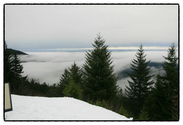
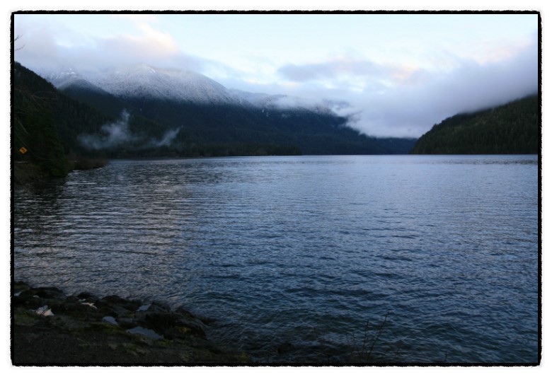
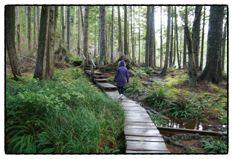
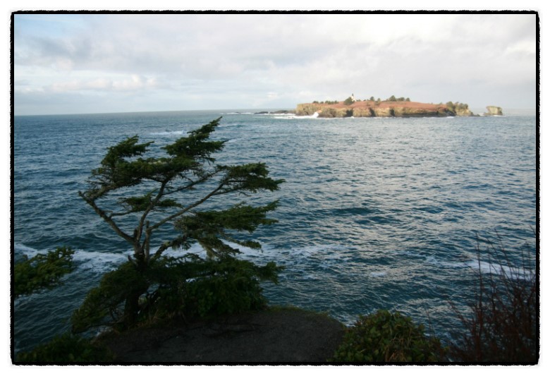
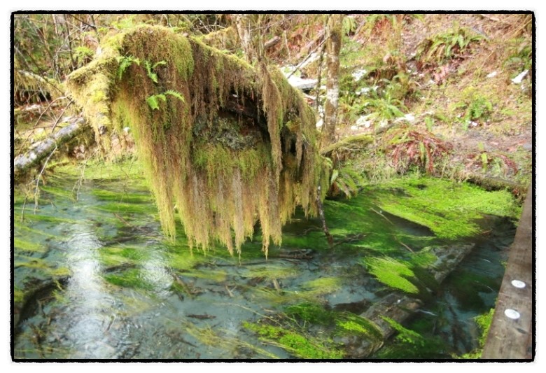
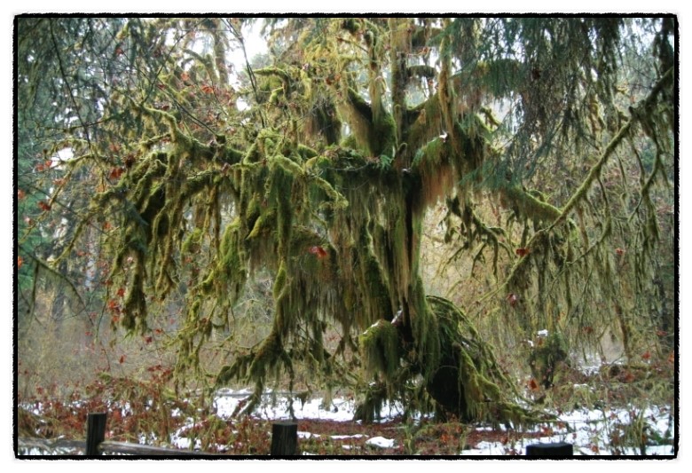
Olympic NP, WA
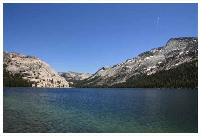
Yosemite NP, CA(7)
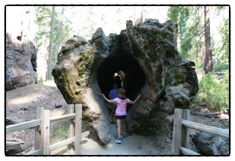
Sequoia NP, CA
Kings Canyon NP, CA
Death Valley NP, CA/NV (2)
Redwood NP, CA
Lassen Volcanic NP, CA
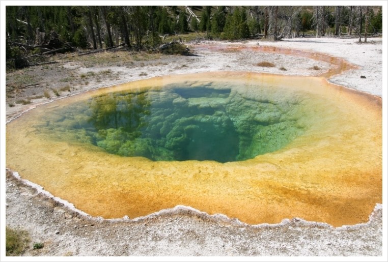
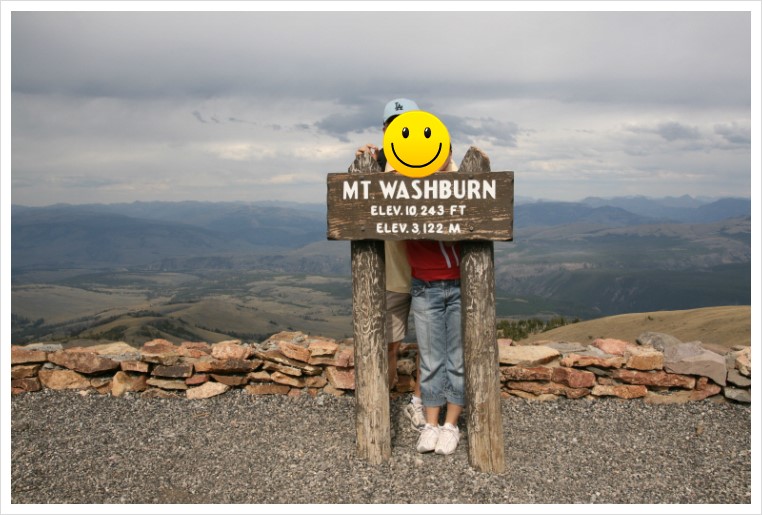
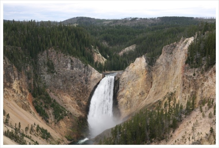
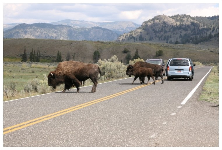
Yellowstone NP, WY/MT/ID
Grand Teton NP, WY
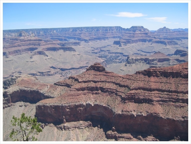
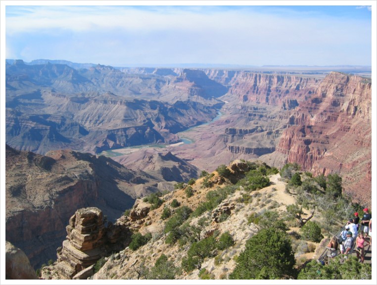
Grand Canyon NP, AZ (4)
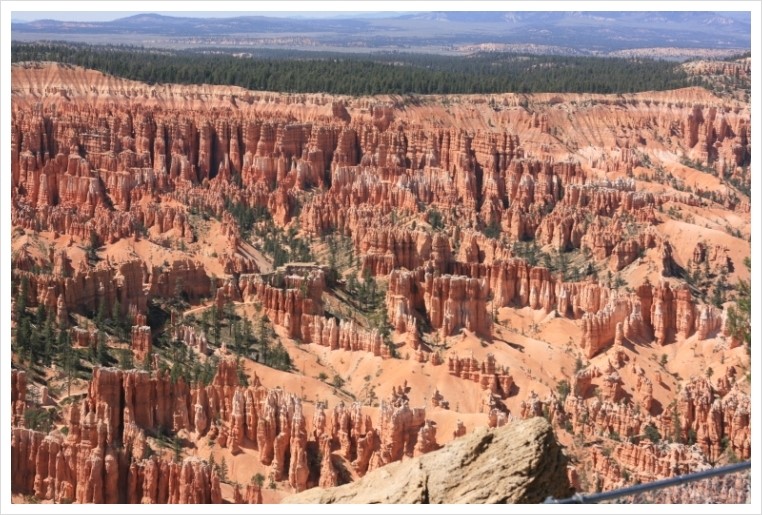
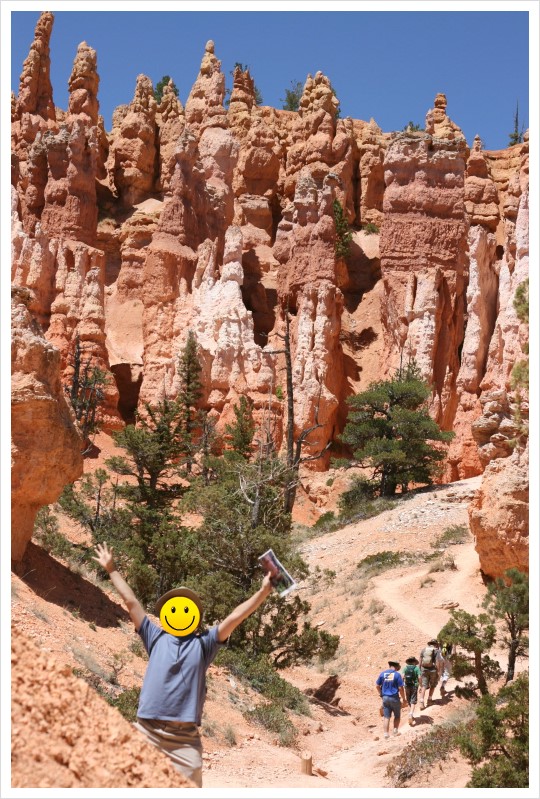
Brace Canyon NP, UT (3)
Zion Canyon NP, UT (2)
Arches Canyon NP, UT (2)
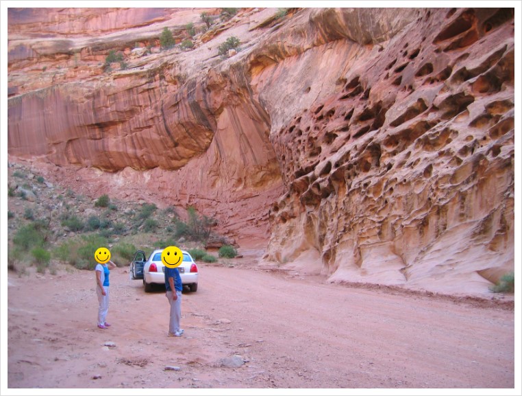
Canyonlands NP, UT (2)
Capitol Reef NP, UT
( )안은 방문 횟수, 없으면 1회 방문
이렇게 17군데 국립공원을 가보았네요. 59곳중에 17군데이니 아직 가봐야 할곳이 많이 남았습니다. 대략 국립공원 분포를 보니 캘리포니아가 9개정도, 알라스카가 8개, 유타 5개, 콜로라도 4개, 아리조나 3개 정도이고 대략 26개주에 자리잡고 있네요. 캘리포니아의 나머지 국립공원은 방문 가능성이 있는데 알라스카의 8군데가 목표 달성에 큰 걸림돌이 되겠습니다.
1. Yellowstone NP
1872년 미국 최초로 국립공원에 지정이 됩니다. 산, 폭포, 간헐천, 야생동물 등등... 볼거리가 너무 많은 곳입니다.
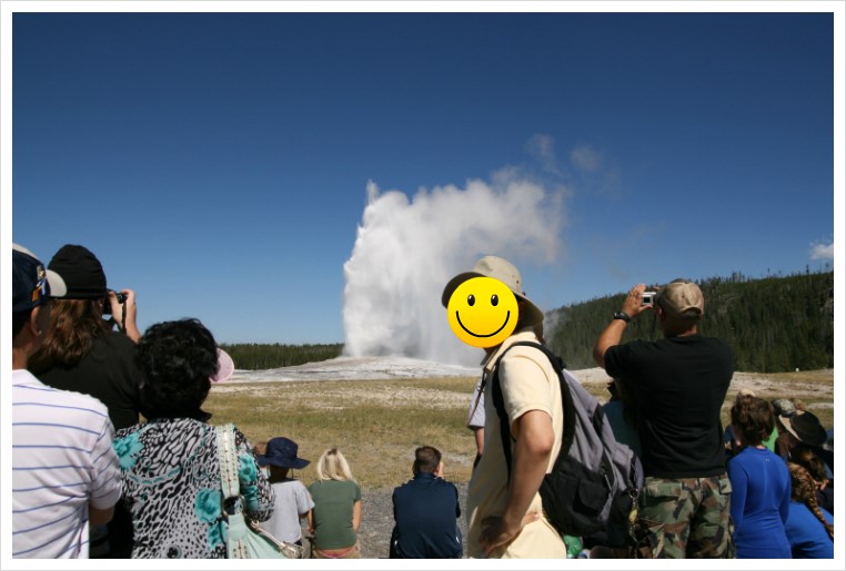
유명세답게 여러 마적단님들의 후기가 올라왔습니다.
2. 레이니님 - 옐로스톤 (Yellowstone), 그랜드 티톤 (Grand Teton) 여행기 1탄
3. 레이니님 - 옐로스톤 (Yellowstone) 여행기 2탄 -겸 3탄 추가 & 마무리
4. 알미안님 - Yellowstone & Grand Teton
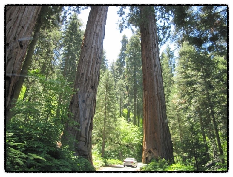
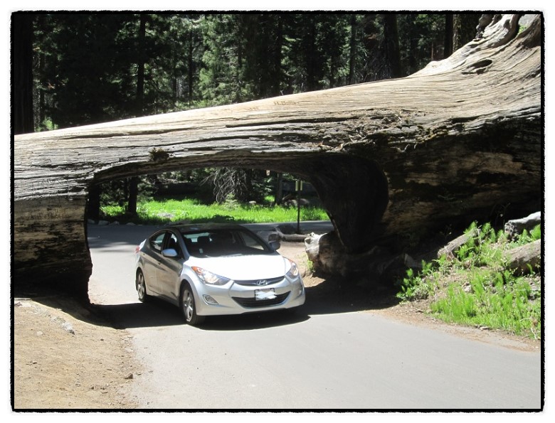
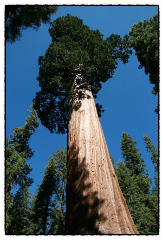
2. Sequoia NP
1890년에 국립공원으로 지정이 됩니다. 2호 국립공원 입니다. (세콰이어 국립공원이 지정되기전에 2호로 지정된 공원이 있었는데 얼마뒤에 국립공원에서 제외가 되었다고 합니다.)
요세미티가 3호 국립공원이고 나중에 Kings Canyon이 국립공원이 되는데 초기 국립공원들이 세콰이어 나무를 보호하기 위해 연달아 지정이 된것에서 세콰이어 나무를 지키려는 미국 사람들의 의지를 엿볼 수 있습니다.
미국 국립공원 마크에 산, 호수, 초원, 들소, 그리고 세콰이어 나무가 들어가 있는걸 볼 수 있습니다. 국립공원에서 세콰이러 나무가 차지하는 비중을 느낄 수가 있습니다.
여행기 둘러 보시구요.
기돌 - Sequoia National Park - Moro Rock Trail
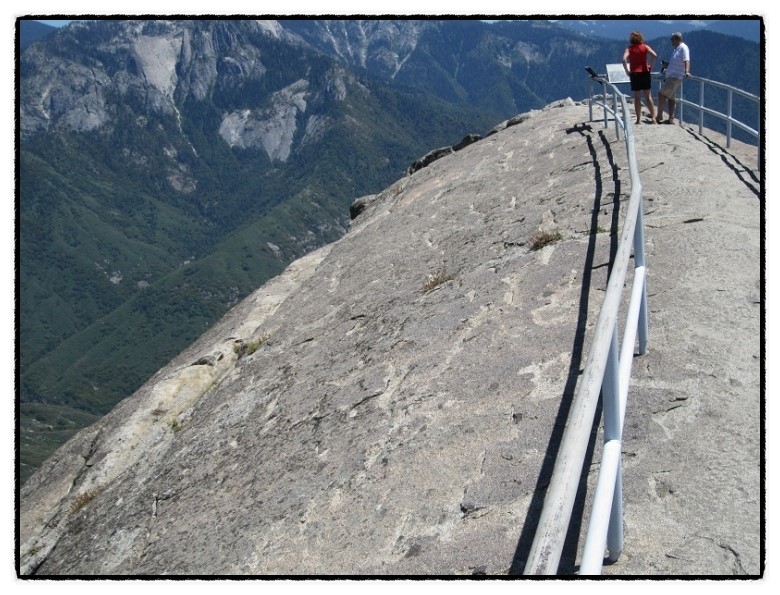
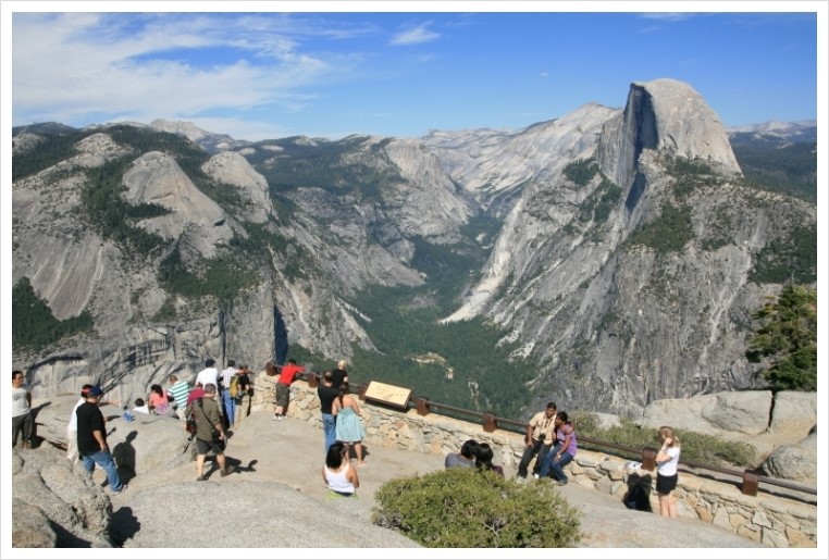
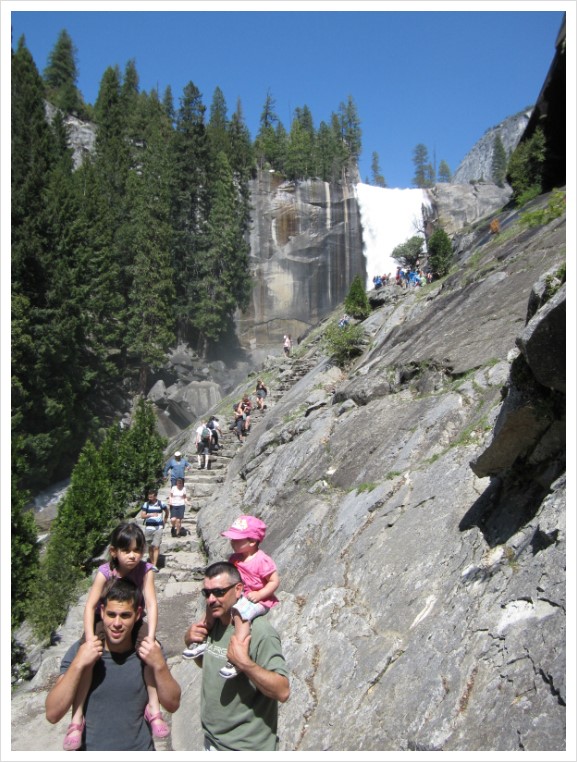
3. Yosemite NP
가장 붐비는 국립공원 중에 하나로 알려져 있습니다. 샌프란이나 베이에서 3~4시간 정도 거리에 있어 이곳에서는 당일치기로도 다녀오기도 해서 자주 방문하게 되는 곳입니다.
Half Dome 등반 트레일이 위험하면서도 유명한데 실제로 사고로 사망한 사람들이 여럿 있어서... 저는 겁나서 못가보고 있습니다. 1971년부터 지금까지 9명이 추락사 했는데 2007년에만 3명이 사망했다고 합니다. ㅎㄷㄷ
하프돔이 반쪽이 잘려 나간걸로 알고 있었는데 어느 글에서 보니 원래 저런 모양이었다네요. 밑에 부분은 빙하에 깍여 나간것이 맞지만 하프돔 위에 부분은 빙하기에도 항상 빙하 밖으로 노출 되어 있었다고 하더라구요.
1. 기스 서부여행5 - 레알 내셔날 파크...요세미티
2. 개골개골님 - 저번주말에 요세미티 다녀왔어요 + Westin Mammoth Lakes
3. 기돌 - Yosemite 국립공원 Vernal Falls trail
4. Mt Rainier NP
요즘 개골개골님이 멋진 사진을 올려주고 계신 곳입니다. Seattle에서도 웅장한 모습이 보이는... 영산의 느낌이 납니다.
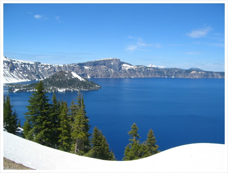
5. Crater Lake NP
Oregon 주의 유일한 국립공원 입니다. 백두산 천지 같은 곳이라고 생각하면 되겠습니다. 날씨가 잘 도와주면 짙푸른 호수의 물빛에 놀라게 됩니다.
티라미수님이 올려주신 환상적인 사진입니다.
티라미수 - [안구정화] Milky way above Crater Lake, Oregon
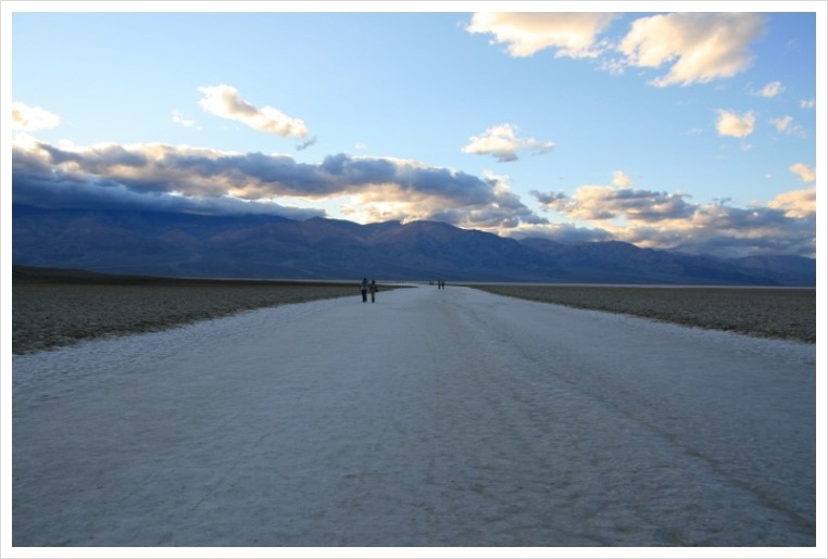
6. Death Valley NP
여름에 방문하기에는 좀 부담스러운 곳이기는 합니다만 황량한 매력이 있는 곳입니다.
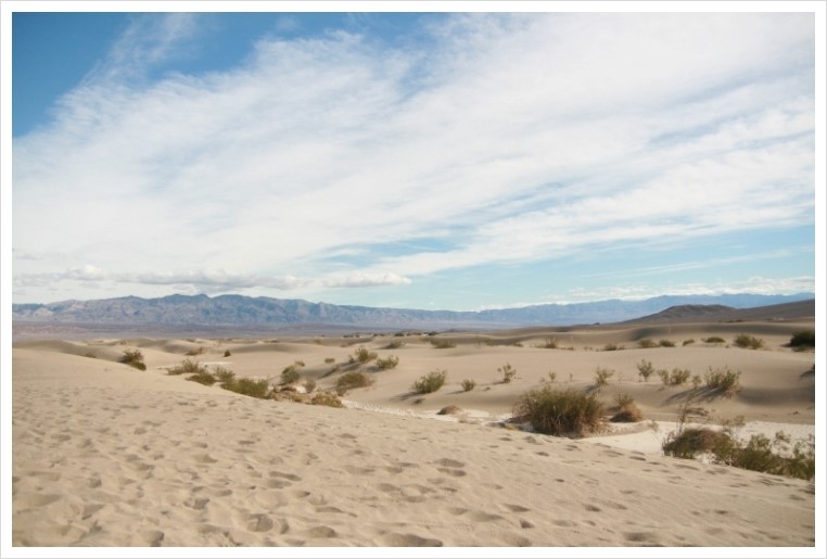
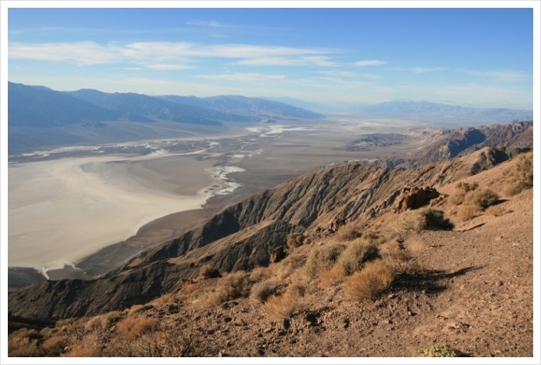
게다가 신기한 움직이는 돌을 볼 수도 있는 곳입니다. 명품 개장수님의 후기에서 확인해 보세요.
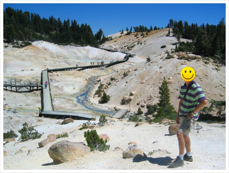
7. Lassen Volcanic NP
Little 옐로우스톤으로 생각하시면 될듯 합니다. 가능하면 옐로우스톤 가시기 전에 방문해 보시는 것이 좋을듯 합니다.
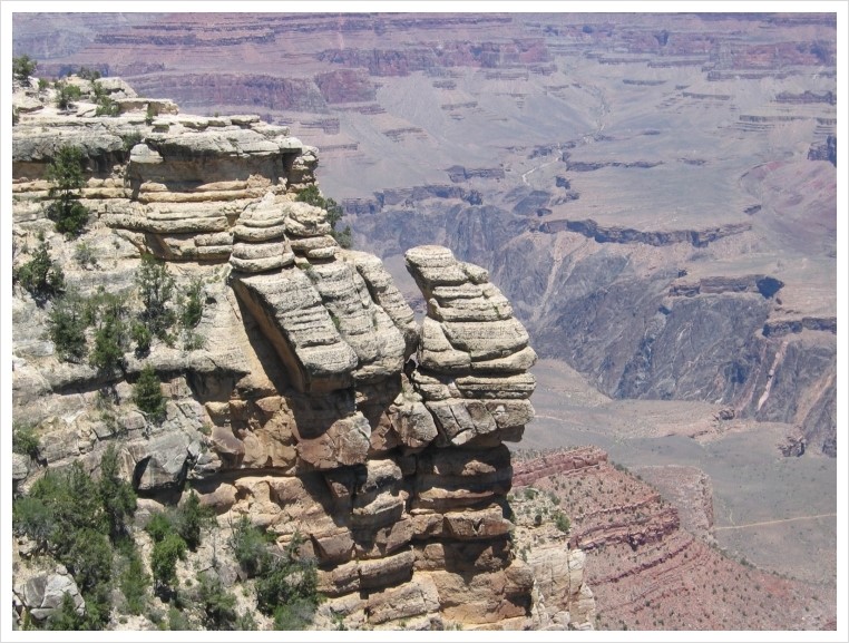
8. Grand Canyon NP
역시 말이 필요 없는 너무나도 잘 알려진 곳입니다. 첫 방문에 대부분 와 하는 탄성을 10여분 지르시는 곳... 그러고 좀 지나면 다 비슷비슷하네 하고 시큰둥 하시기도 하는곳 ㅎㅎㅎ
South Rim 지역 방문이 많지만 North Rim도 멋지다고 하는데 North Rim은 아직 기회가 없었습니다. South Rim에서 계곡 밑으로 내려가는 트레일이 유명한데 엄두가 나지 않아 못하고 있습니다.
9. Bryce Canyon NP
의외로 그랜드캐년 보다 평이 좋은 공원입니다. 특이한 지형 모습과 붉은색이 사람들을 매료시키는 듯합니다. Navajo 트레일과 Queen's garden 트레일은 시간이 오래 걸리지 않으면서 환상적인 모습을 보여줍니다. 꼭 하셔야 하는 트레일입니다.
RSM님 후기입니다.
RSM - grnad canyon, bryce canyon and zion canyon _2편
10. Zion Canyon NP
Bryce Canyon 과 묶어 함께 방문하는 경우가 많은 곳입니다. 여름에 Narrows 지역으로 강줄기 따로 들어가는 트레일 좋습니다.
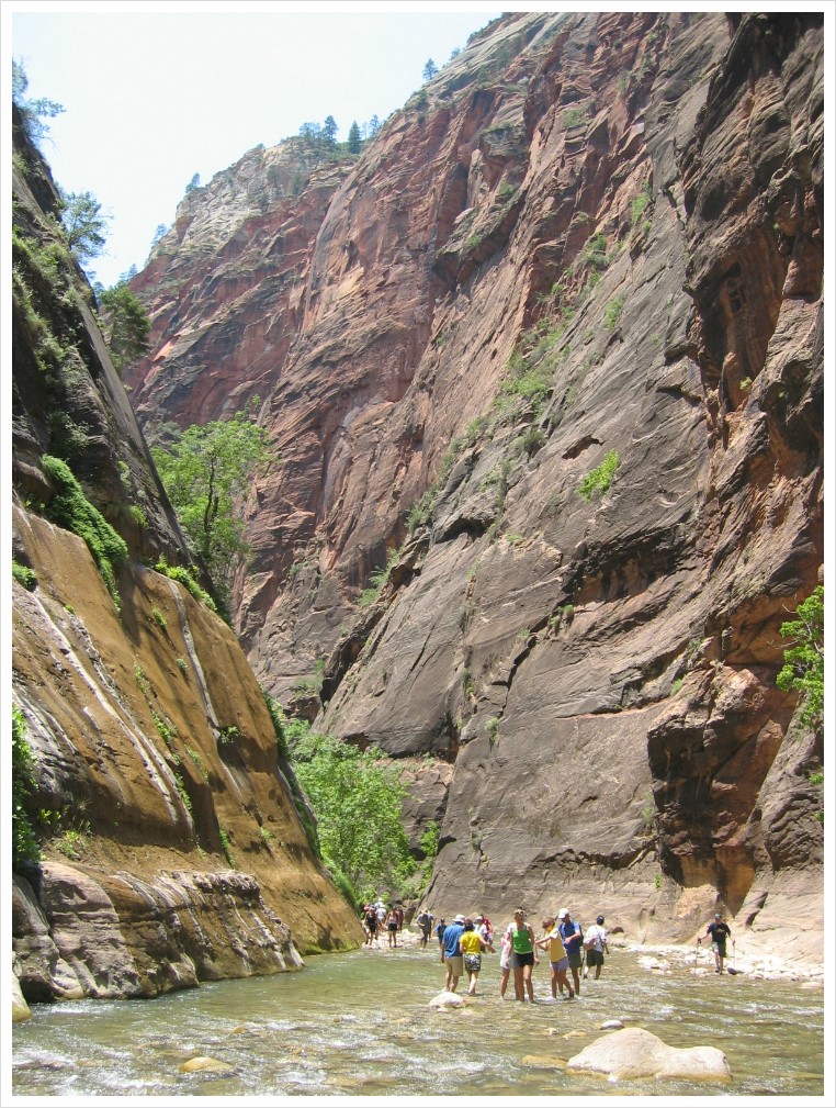
RSM - grnad canyon, bryce canyon and zion canyon _3편
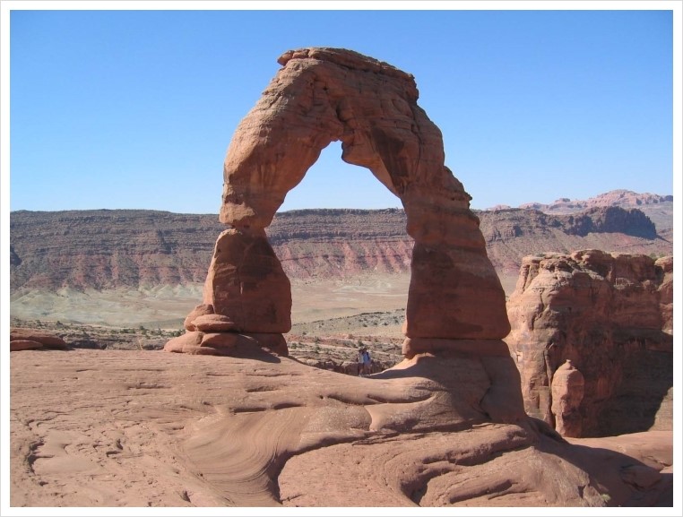
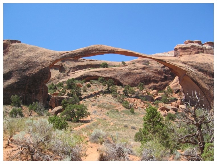
11. Arches Canyon NP
개인적으로 가장 인상적인 국립공원으로 첫째 둘째로 생각하는 곳입니다. Delicate Arch, Landscape Arch 등등 수많은 멋진 Arch 가 있는 곳이죠. 무너지기 전에 어서들 구경 다녀오세요.
무조건 Delicate Arch는 밑에까지 가서 보셔야 합니다. 다리 사이에 저희 부부가 있습니다.^^
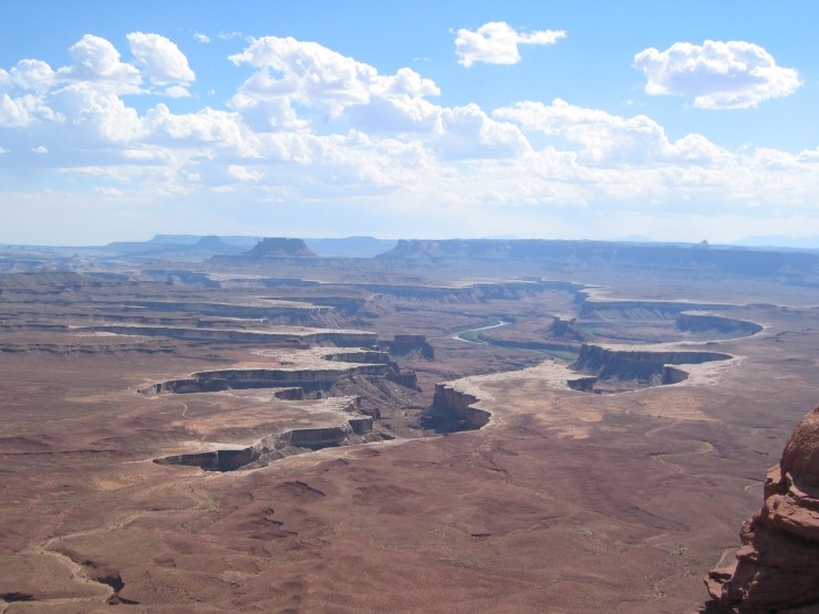
12. Canyonland NP
그랜드캐년과 비슷한듯 하지만 또 다른 지형 모습을 볼 수 있는 곳입니다. 4륜구동차를 몰고 비포장 길을 따라 들어가는 액티비티가 유명하다는데 못해봤습니다.
13. Capitol Reef NP
그랜드 서클 돌면서 중간에 방문하게 되는 곳입니다. 많이 알려져 있지는 않지만 시간이 되면 들려볼 만합니다. 하긴 저도 이곳에는 몇시간 밖에 못 머물렀었네요.
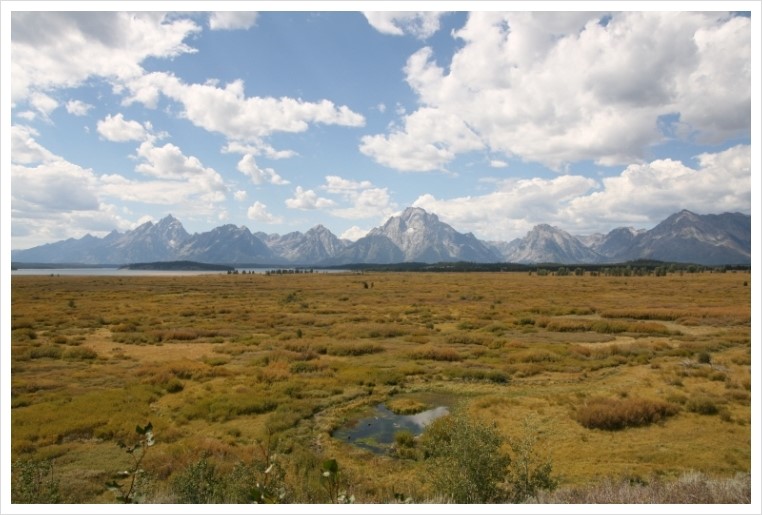
14. Grand Teton NP
옐로우스톤은 많이 가시지만 근처에 있는 이곳을 지나치시는 경우가 있는데요, 이곳 역시 꼭 가보셔야 하는 곳이 되겠습니다. 고봉들이 병풍처럼 늘어선 모습이 대단한 곳입니다.
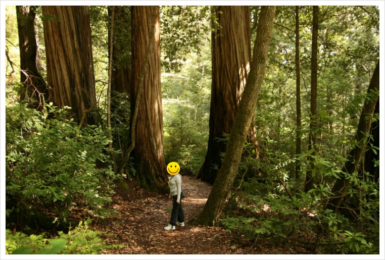
15. Redwood NP
입장료가 아직은 무료인곳 입니다. Sequoia 나무는 부피 체적으로 세계에서 제일 큰 나무고 미서부 해안가에 분포하는 레드우드는 높이가 가장 높은 나무라고 합니다.
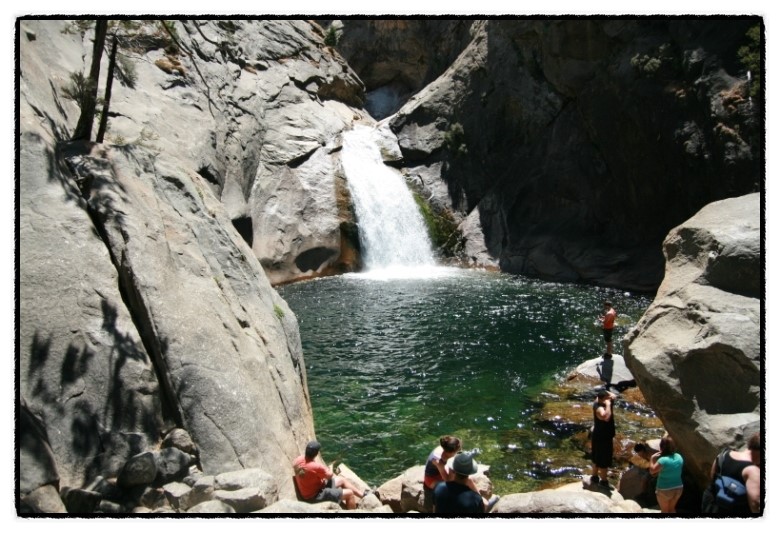
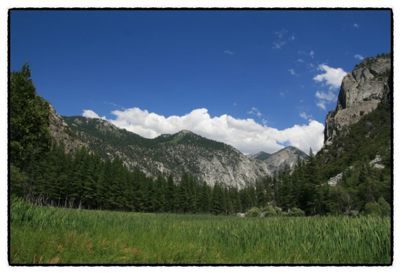
16. Kings Canyon NP
세콰이어 국립공원과 붙어 있어서 함께 둘러보게 되는 곳입니다. 역시 세콰이어 나무, 초원, 폭포등을 둘러 볼 수 있습니다.
17.Olympic NP
역시 요즘 개골님이 명품 사진을 올려주고 계신곳이지요. 산, 호수, 폭포, 우림지역, 그리고 미본토 북서부 최 끝단 지점이 있는곳 입니다.
국립 공원은 시간 여유가 있다면 레인저 프로그램에 동참해 보는 것도 좋은 경험이 될듯 합니다. 이제 17곳을 다녔는데 58 군데를 모두 가볼 수 있을까요?^^
국립공원 얘기가 나오면 항상 제가 하는 말이 있습니다. '동부는 망했어' ㅋㅋ
서부에 계신분들.... 부럽습니다....
+1
그리고 중부도 망했어요. ㅋㅋ
+1
동부엔 아카디아가 있잖아요 ㅋㅋ
이래서 동부가 싫어서 서부로 떠납니다 ㅋㅋ
어휴.... 동부 사람들 불쌍해서 겨우겨우 넣어준거 같아요...
진짜 다음 잡 잡을땐 놀러갈 것도 생각해야 할듯...
마일 모으셔서 서부로 자주 놀러 오시면 되지요^^
동부에 살다가 좋은 서부 놀러 가끔 가는것도 좋은생각이신거 같아요
매일 좋은곳을 보면 좋은지 모르고 살수도 있잖아요......
전그렇게 제 자신에게 최면을 걸렵니당 ㅋㅋ
최면만 거시지 마시고 종종 놀러 오세요 ㅎㅎㅎ
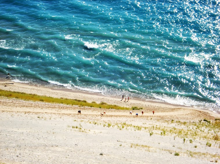
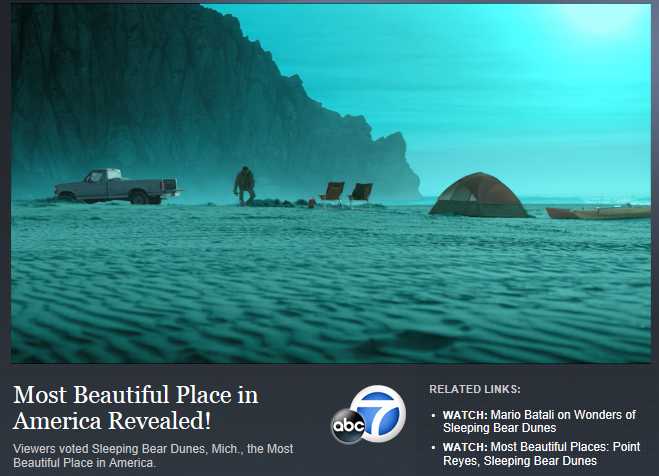
중부에 sleeping bear dunes 가보셨나요? 저는 거기 너무 좋더군요. 아름다운 호수와 예쁜 듄들. 캠핑하기도 좋고, 주위에 Traverse City 라는 도시에 좋은 맥주/와인과 괜찮은 음식점도 있구요. 아, 근처에 있는 맥키나 아일랜드도 예쁘구요.
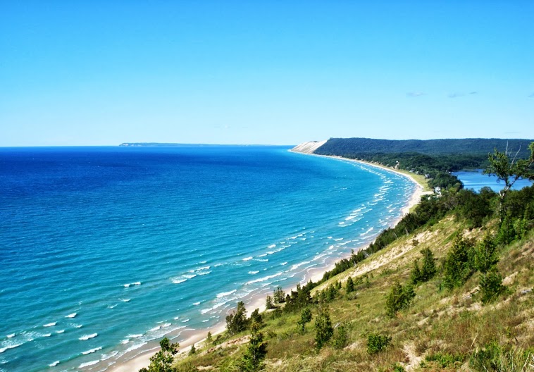
원근을 잘 고려하여 보세요. 저 밑에 듄을 기어올라오는 사람들
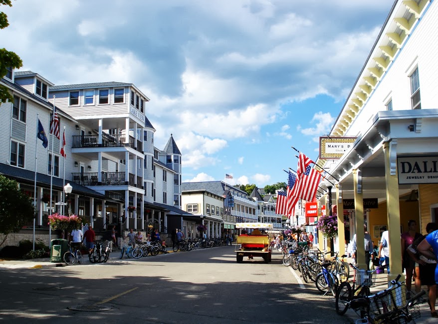
여기는 맥키나 아일랜드.
여기도 좋네요~ 중부는 서부처럼 장대한 자연은 없지만, 그래도 아기자기하고 예쁜 휴양지 꽤 있는 것 같아요. 제가 있는 곳에서 가까운 동네 중 Lake Geneva라고 있는데요. 1시간 반 정도면 가서 가끔 가는데 너무 예쁘고 좋아요. 사실 미시간호는 너무 커서 이쁜지는 모르겠지만, 거기는 유람선으로 2시간이면 다 돌 수 있는 크기의 호수가 있는데 너무 예쁘고 동네 자체가 참 산들산들하죠. 올려주신 곳은 집에서 6시간 정도 걸릴 것 같은데, 저는 운전실력이 장거리용으로는 미숙해서 언제 운전 잘하는친구 놀러오면 한번 가봐야겠군요~
요런 알찬 숨은 정보 좋습니다. 사진 너무 멋진데요? 리스트에 하나 더 올라가네요~~~
네에, 저곳 sleeping bear dunes 역시 national park 이죠. http://www.sleepingbeardunes.com/
ABC 방송국의 Good Morning America 에서 Most Beautiful Place in America 에 뽑혔습니다. Hidden Gem 이라고 할 수 있겠어요.
관련 비디오는 여기에.
http://abcnews.go.com/GMA/video/gma-beautiful-places-america-point-reyes-ca-sleeping-14262721
미시간 호수가 크다보니, 시카고나 미시간 어디서나 이 호수를 볼 수는 있지만, sleeping bear dunes 에서 볼 수 있는 곳이 가장 아름다웠던 기억이 납니다. (이게 같은 호수인가 싶을 정도로). 호수에 물감을 탄 듯한 저 색깔에 무척 감탄했습니다.
아이고 기돌님 대단하신 정성이 들어가있는 포스팅이네요. ㅎㅎ
미국에 거주한 기간이 3년이 채 안되는 상황에서 그래도 기돌님 가보신곳의 반은 가봤네요. ^^
계속 서부에 거주했던 덕분에 이정도 다녔는데 앞으로는 추가 하기가 쉽지 않아 보입니다. 아우토반님 벌써 10곳 가까이 돌아보셨다니 엄청난 스피드 이십니다.
부럽지 않다..부럽지 않다... 주문을 외워봅니다...ㅋㅋㅋㅋㅋ 저도 미국 거주는 3년인데 아직 한군데도 못가봤네요ㅎㅎ
아무래도 서부쪽에 사시는 분들이 국립공원 방문하시기가 수월하시겠죠. 이카루스님도 한번 둘러 보러 우세요^^
아 사진들 좋습니다..... 역시 NP 는 거의다 서부에 있죠? 저도 십여군데 가봤네요. 기돌님 리스트에 없는곳 이라면 얼마전 다녀왔던 마이애미 근처 Byscane NP 이 있네요.
http://en.wikipedia.org/wiki/List_of_national_parks_of_the_United_States 다른곳은 어떤곳이 있나하고 리스트를 보니 뜻밖의 미시간에 하나 있네요? 오호
한번 알아보고 여름에 다녀와야겠습니다. 차로 가볼만한 NP 가 있었네요.
순서와 선호도는 다른거죠? 기돌님이 꼽는 1위는 어디신가요?
저도 저 링크 참고 했었어요.^^ 저는 개인적으로 아치스 캐년과 브라이스 캐년을 1,2위로 꼽고 있어요. 아치스 캐년의 Delicate Arch trail 과 브라이스 캐년의 Navajo/Queens Garden 트레일이 너무 인상적이어서 인듯 합니다. 이 트레일들이 아주 힘들지도 않으면서 (1~2 시간 정도 트레일) 환상적인 장면을 볼 수 있어서 그랬게 생각한듯 합니다. 사실 다른 공원에 수많은 명품 트레일들이 있을텐데 몇개밖에 못해서이기도 한데... 지금까지 트레일중에 이곳들 인상이 너무 좋았어요.^^
쿨대디님 그랜드 서클부터 한번 돌아 보세요. ^^
초롱님 잘 봐주셔서 감사해요^^
중부사는 저로서는 정말 부럽네요.. 전 Capitol Reef과 Rocky Mountain만 가봤는데, 둘다 완전 만족했었죠.
다른 곳도 여건이 되면 꼭 가보고 싶네요.. ㅋㅋ
shipge님이 가본신곳 만족 하셨다니 분명 다른 국립 공원들도 좋아하실거에요. 마모가 마일을 만들어주니 휴가때 마다 돌아보세요^^
오~~ 멋있습니다.
오~~ 잡곡님 감사합니다.ㅎㅎㅎ
서부에서 국립공원 다니다 동부오니 국립공원들이 무슨 캘리포니아나 아리조나 주립공원만도 못한 것 같습니다.
동부는 망했고 여기 리스트에 끼우고 싶은것이 캐나다 국립공원입니다. 특히 밴프는 꼭 가봐야 할 곳이 아닌가 합니다.
아~~~ 그렇죠. 캐나다 국립공원도 섭렵해야 하는 리스트에 꼭 넣어야죠. 페어몬트 카드 만들어서 밴프가는 날을 손꼽아 기다리고 있습니다.^^
어익후... 사진들 보니까 기억도 새록새록 살아나고 좋네요.
이번 6월달에 옐로스톤 다녀오면 저도 기돌님 리스트에 있는 국립공원은 다 다녀오게 될 것 같아요 ^^
개골님이 더 많이 다녀 오신것 같던데요?^^ Channel Islands NP 도 다녀 오셨고 말이죠... 찾다 보니 멀지 않은 곳에 2013년 금년에 국립공원으로 편입이 된곳이 있더군요. Pinnacles NP 이 말이죠. 언제 주말에 한번 다녀와봐야 겠어요.
저런 멋진곳들중에 가본곳이 한군데도 없네요 ㅠㅠ
역시 동부는.........OTL
조만간 서부 방문계획이 있는데 요세미티 함 가봐야 겠습니당^^
오실때 여러곳 모아서 쓱 돌아 보시면 되지요.^^ 동부분들의 실망감, 좌절감이 꽤 크신가 봅니다.ㅎㅎㅎ
와... 정리 한번 대단하시네요...
가봐야 할곳들이 이렇게 많다니..
올해가 가기전에 적어도 2군데는 목표를 잡아야겠습니다..
어여 돌아 보시고 명품 사진, 후기 남겨 주셔야지요.^^ 개장수님 사진 보니 더욱더 움직이는 돌 보러 가고 싶더라구요.ㅎㅎㅎ
이렇게 모아놓으니 참 멋있군요. 그런데 이게 후기인가요 설문인가요? 아무도 설문에 동참을 안하시는데 제가 처음으로 설문에 동참해 보겠습니다. 리스트를 만들고 보니 다들 꽤 오래전에 다녀온 곳들이군요.
Arches
Badlands (이곳은 Mount Rushmore 가는길에 들렸는데 화석에 관심있는분들, 애들 교육에 좋을듯)
Big Bend (이곳에 다녀오신분들은 Texas 사신분들 이외에는 별로 않될듯.)
Bryce
Carlsbad(2, 동굴의 규모가 엄청나죠. 해질무렵 밖쥐떼가 동굴에서 나가는 모습도 장관입니다.)
Channel Island
Crater lake
Death Valley (2)
Denali (McKinley, 곰들이 뛰어놀던 능선, 잊을수 없는 풍경중 하나입니다.)
Glacier Bay (빙하가 떨어지는걸 구경허는 재미)
Grand Canyon (3)
Grand Teton (2)
Guadalupe Mountain (이곳은 대부분 사람들이 모를듯. 처음보면 뭐 이런 국립공원이?)
Volcano Park (Big Island)
Hot Springs
Joshua Tree (2)
Katmai (계곡을 가득 메운 연어떼)
Kings Canyon (3)
Lassen (3)
Mesa Verde (2, 과거 American Indian 의 거주지)
Mount Rainier
Olympic
Redwood (10? 셀수가 없거나 기억력이 안좋거나.)
Rocky Mountain
Sequoia (3)
Yellowstone (3)
Yosemite (10?)
Zion
28곳... 역시 김미형님이 탑을 차지 하셨네요. 벌써 반이나 다녀 오셨습니다. 존경합니다.^^
역시 기스님... 만만치 않으십니다. 척박한 환경에서도 11군데나 다녀 오셨군요. 알라스카와 플로리다쪽 국립공원이 눈에 띱니다. 골고루 다녀 오셨네요. 전 너무 서부에만 치우쳐 있어서...
내년에 싸웨 컴페니언이 가능해 진다면 몇 군데 다녀 볼 수 있지 않을까 생각만 해봅니다.^^
우앙~ 좋은 국립공원 많이 다니셨네요~ 전 캠핑 정말 좋아하는데, 아이가어릴땐 엄두도 못내고 이제 슬슬 시작해봐야겠어요.
복돌맘님 캠핑 좋아 하신다니 국립공원 아주 좋아하시겠어요. 슬슬 시동 거시는것 보니 복돌맘님이 저보다 훨씬 먼저 목표 달성 하실듯 합니다.
아~ 그래도 마우이의 할레아칼라 + 빅아일랜드 Volcano national park 은 가봤네요. 참 저 8월에 Big Basin redwoods 로 캠핑갑니다.
근처에 계시면 하루 잡아 바베큐 하러 오세요. 아마 Pot luck 이 될것이므로 음식을 조금씩 가져오시면 되시겠어요 :) 유자언니 오실거죵?
하와이 다녀 오신게 더 부러워요. 아직 하와이를 못가봤어요.^^ 벌써 캠핑 시동 거셨네요. 베이까지 오시네요 ㅎㅎㅎ
7월말에 나파와이너리 갔다가 다시 내려왔다가 일주일 있다 다시 캠핑간답니다~ 컴패니언 패스 있을때 내셔널 팍 많이 가보는거 내년까지 할수 있나 몰겠네요~~~
베이에서 하와이 넌스탑으로 가는 뱅기가 많은 걸로 아는데 ... 조만간 가실거면서 부러워하실거 없으세요~
Big Basin 좋죠!! ^^
거의 다 가서 꼬불꼬불 내려가는데 별로 멀미 안 하는 저까지도 잠깐 고비가.... ㅎㅎㅎ
기돌님의 질문이 흥미로와 한번 올려 봅니다. 저도 미국에 있는 국립공원은 다 가보는게 나름 계획인데 지난 5년간 47곳을 다녀 왔네요 (못 가본곳중 대부분은 알라스카 오지에 있는곳이죠). Wikipedia자료를 빌려 아래 제가 다녀온곳 서열해 봤습니다.
개인적으로 Dry Tortugas, Big Bend, & Everglades 등이 인상적이었고 Cuyahoga Valley 는 그다지 흥미롭지 않았습니다 (겨울에 다녀와서 그럴까요?) 기회가 되면 Katmai 가서 곰 구경을 꼭 해보고 싶네요.
갈때마다 방문센터에 들려 조그마한 자석 souvenir 를 꼭 사오는데 나름 소중한 수집품이 됐습니다.
| Acadia |  | Maine 44°21′N 68°13′W / 44.35°N 68.21°W | February 26, 1919 | 47,389.67 acres (191.8 km2) | Covering most of Mount Desert Island and other coastal islands, Acadia features the tallest mountain on the Atlantic coast, granite peaks, ocean shoreline, woodlands, and lakes. There are freshwater, estuary, forest, and intertidal habitats.[6] |
|---|---|---|---|---|---|
| Arches |  | Utah 38°41′N 109°34′W / 38.68°N 109.57°W | November 12, 1971 | 76,518.98 acres (309.7 km2) | This site features more than 2,000 natural sandstone arches, including the Delicate Arch. In a desert climate millions of years of erosion have led to these structures, and the arid ground has life-sustaining soil crust and potholes, natural water-collecting basins. Other geologic formations are stone columns, spires, fins, and towers.[8] |
| Badlands |  | South Dakota 43°45′N 102°30′W / 43.75°N 102.50°W | November 10, 1978 | 242,755.94 acres (982.4 km2) | The Badlands are a collection of buttes, pinnacles, spires, and grass prairies. It has the world's richest fossil beds from the Oligocene epoch, and there is wildlife including bison, bighorn sheep, black-footed ferrets, and swift foxes.[9] |
| Big Bend |  | Texas 29°15′N 103°15′W / 29.25°N 103.25°W | June 12, 1944 | 801,163.21 acres (3,242.2 km2) | Named for the Bend of the Rio Grande along the US–Mexico border, this park includes a part of the Chihuahuan Desert. A wide variety of Cretaceous and Tertiary fossils as well as cultural artifacts of Native Americans exist within its borders.[10] |
| Biscayne |  | Florida 25°39′N 80°05′W / 25.65°N 80.08°W | June 28, 1980 | 172,924.07 acres (699.8 km2) | Located in Biscayne Bay, this park at the north end of the Florida Keys has four interrelated marine ecosystems: mangrove forest, the Bay, the Keys, and coral reefs. Threatened animals include the West Indian Manatee, American crocodile, various sea turtles, and peregrine falcon.[11] |
| Black Canyon of the Gunnison |  | Colorado 38°34′N 107°43′W / 38.57°N 107.72°W | October 21, 1999 | 32,950.03 acres (133.3 km2) | The park protects a quarter of the Gunnison River, which has dark canyon walls from the Precambrian era. The canyon has very steep descents, and it is a site for river rafting and rock climbing. The narrow, steep canyon, made of gneiss and schist, is often in shadow, appearing black.[12] |
| Bryce Canyon |  | Utah 37°34′N 112°11′W / 37.57°N 112.18°W | February 25, 1928 | 35,835.08 acres (145.0 km2) | Bryce Canyon is a giant natural amphitheatre along the Paunsaugunt Plateau. The unique area has hundreds of tall hoodoos formed by erosion. The region was originally settled by Native Americans and later by Mormon pioneers.[13] |
| Canyonlands |  | Utah 38°12′N 109°56′W / 38.2°N 109.93°W | September 12, 1964 | 337,597.83 acres (1,366.2 km2) | This landscape was eroded into canyons, buttes, and mesas by the Colorado River, Green River, and their tributaries, which divide the park into three districts. There are rock pinnacles and other naturally sculpted rock, as well as artifacts from Ancient Pueblo Peoples.[14] |
| Capitol Reef |  | Utah 38°12′N 111°10′W / 38.20°N 111.17°W | December 18, 1971 | 241,904.26 acres (979.0 km2) | The park's Waterpocket Fold is a 100-mile (160 km) monocline that shows the Earth's geologic layers. Other natural features are monoliths and sandstone domes and cliffs shaped like the United States Capitol.[15] |
| Carlsbad Caverns |  | New Mexico 32°10′N 104°26′W / 32.17°N 104.44°W | May 14, 1930 | 46,766.45 acres (189.3 km2) | Carlsbad Caverns has 117 caves, the longest of which is over 120 miles (190 km) long. The Big Room is almost 4,000 feet (1,200 m) long, and the caves are home to over 400,000 Mexican Free-tailed Bats and sixteen other species. Above ground are the Chihuahuan Desert and Rattlesnake Springs.[16] |
| Channel Islands |  | California 34°01′N 119°25′W / 34.01°N 119.42°W | March 5, 1980 | 249,561.00 acres (1,009.9 km2) | Five of the eight Channel Islands are protected, and half of the park's area is underwater. The islands have a unique Mediterranean ecosystem. They are home to over 2,000 species of land plants and animals, and 145 are unique to them. The islands were originally settled by the Chumash people.[17] |
| Congaree |  | South Carolina 33°47′N 80°47′W / 33.78°N 80.78°W | November 10, 2003 | 26,545.86 acres (107.4 km2) | On the Congaree River, this park is the largest portion of old-growth floodplain forest left in North America. Some of the trees are the tallest in the Eastern US, and the Boardwalk Loop is an elevated walkway through the swamp.[18] |
| Crater Lake |  | Oregon 42°56′N 122°06′W / 42.94°N 122.1°W | May 22, 1902 | 183,224.05 acres (741.5 km2) | Crater Lake lies in the caldera of Mount Mazama formed 7,700 years ago after an eruption. It is the deepest lake in the United States and is known for its blue color and water clarity. There are two islands in the lake, and, with no inlets or outlets, all water comes through precipitation.[19] |
| Cuyahoga Valley |  | Ohio 41°14′N 81°33′W / 41.24°N 81.55°W | October 11, 2000 | 32,860.73 acres (133.0 km2) | This park along the Cuyahoga River has waterfalls, hills, trails, and displays about early rural living. The Ohio and Erie Canal Towpath Trail follows the Ohio and Erie Canal, where mules towed canal boats. The park has numerous historic homes, bridges, and structures.[20] The park also offers a scenic train ride with various trips available. [21] |
| Death Valley |  | California, Nevada 36°14′N 116°49′W / 36.24°N 116.82°W | October 31, 1994 | 3,372,401.96 acres (13,647.6 km2) | Death Valley is the hottest, lowest, and driest place in the United States. Daytime temperatures have topped 130°F (54°C) and it is home to Badwater Basin, the lowest point in the Western Hemisphere. There are canyons, colorful badlands, sand dunes, mountains, and over 1000 species of plants in this graben on a fault line. Further geologic points of interest are salt flats, springs, and buttes.[22] |
| Denali |  | Alaska 63°20′N 150°30′W / 63.33°N 150.50°W | February 26, 1917 | 4,740,911.72 acres (19,185.8 km2) | Centered around the Mount McKinley, the tallest mountain in North America, Denali is serviced by a single road leading to Wonder Lake. McKinley and other peaks of the Alaska Range are covered with long glaciers and boreal forest. Wildlife includes grizzly bears, Dall sheep, caribou, and gray wolves.[23] |
| Dry Tortugas |  | Florida 24°38′N 82°52′W / 24.63°N 82.87°W | October 26, 1992 | 64,701.22 acres (261.8 km2) | The Dry Tortugas on the west end of the Florida Keys are the site of Fort Jefferson, the largest masonry structure in the Western Hemisphere. With most of the park being water, it is the home of coral reefs and shipwrecks and is only accessible by plane or boat.[24] |
| Everglades |  | Florida 25°19′N 80°56′W / 25.32°N 80.93°W | May 30, 1934 | 1,508,537.90 acres (6,104.8 km2) | The Everglades are the largest subtropical wilderness in the United States. This mangrove ecosystem and marine estuary is home to 36 protected species, including the Florida panther, American crocodile, and West Indian manatee. Some areas have been drained and developed; restoration projects aim to restore the ecology.[25] |
| Glacier |  | Montana 48°48′N 114°00′W / 48.80°N 114.00°W | May 11, 1910 | 1,013,572.41 acres (4,101.8 km2) | Part of Waterton Glacier International Peace Park, this park has 26 remaining glaciers and 130 named lakes under the tall Rocky Mountain peaks. There are historic hotels and a landmark road in this region of rapidly receding glaciers. These mountains, formed by an overthrust, have the world's best sedimentary fossils from the Proterozoic era.[27] |
| Grand Canyon |  | Arizona 36°04′N 112°08′W / 36.06°N 112.14°W | February 26, 1919 | 1,217,403.32 acres (4,926.7 km2) | The Grand Canyon, carved out by the Colorado River, is 277 miles (446 km) long, up to 1 mile (1.6 km) deep, and up to 15 miles (24 km) wide. Millions of years of exposure has formed colorful layers of the Colorado Plateau in mesas and canyon walls.[29] |
| Grand Teton |  | Wyoming 43°44′N 110°48′W / 43.73°N 110.80°W | February 26, 1929 | 309,994.66 acres (1,254.5 km2) | Grand Teton is the tallest mountain in the Teton Range. The park's Jackson Hole valley and reflective piedmont lakes contrast with the tall mountains, which abruptly rise from the glacial sage-covered valley.[30] |
| Great Basin |  | Nevada 38°59′N 114°18′W / 38.98°N 114.30°W | October 27, 1986 | 77,180.00 acres (312.3 km2) | Based around Wheeler Peak, the Great Basin has 5,000-year-old bristlecone pines, glacial moraines, and the limestone Lehman Caves. It has some of the country's darkest night skies, and there are animal species including Townsend's big-eared bat, Pronghorn, and Bonneville cutthroat trout.[31] |
| Great Sand Dunes |  | Colorado 37°44′N 105°31′W / 37.73°N 105.51°W | September 13, 2004 | 42,983.74 acres (173.9 km2) | The tallest dunes in North America are up to 750 feet (230 m) tall and neighbor grasslands, shrublands and wetlands. They were formed by sand deposits of the Rio Grande on the San Luis Valley. The park also has alpine lakes, six 13,000-foot mountains, and ancient forests.[32] |
| Great Smoky Mountains |  | North Carolina, Tennessee 35°41′N 83°32′W / 35.68°N 83.53°W | June 15, 1934 | 521,490.13 acres (2,110.4 km2) | The Great Smoky Mountains, part of the Appalachian Mountains, have a wide range of elevations, making them home to over 400 vertebrate species, 100 tree species, and 5000 plant species. Hiking is the park's main attraction, with over 800 miles (1,300 km) of trails, including 70 miles (110 km) of the Appalachian Trail. Other activities are fishing, horseback riding, and visiting some of nearly 80 historic structures.[33] |
| Guadalupe Mountains |  | Texas 31°55′N 104°52′W / 31.92°N 104.87°W | October 15, 1966 | 86,415.97 acres (349.7 km2) | This park has Guadalupe Peak, the highest point in Texas, the scenic McKittrick Canyon full of Bigtooth Maples, part of the Chihuahuan Desert, and a fossilized reef from the Permian.[34] |
| Haleakalā |  | Hawaii 20°43′N 156°10′W / 20.72°N 156.17°W | August 1, 1916 | 29,093.67 acres (117.7 km2) | The Haleakalā volcano on Maui has a very large crater with many cinder cones, Hosmer's Grove of alien trees, and the native Hawaiian Goose. The Kipahulu section has numerous pools with freshwater fish. This National Park has the greatest number of endangered species.[35] |
| Hawaii Volcanoes |  | Hawaii 19°23′N 155°12′W / 19.38°N 155.20°W | August 1, 1916 | 323,431.38 acres (1,308.9 km2) | This park on the Big Island protects the Kīlauea and Mauna Loa volcanoes, two of the world's most active. Diverse ecosystems of the park range from those at sea level to 13,000 feet (4,000 m).[36] |
| Hot Springs |  | Arkansas 34°31′N 93°03′W / 34.51°N 93.05°W | March 4, 1921 | 5,549.75 acres (22.5 km2) | The only National Park in an urban area, this smallest National Park is based around the natural hot springs that have been managed for public use. Bathhouse Row preserves 47 of these with many beneficial minerals.[37] |
| Joshua Tree |  | California 33°47′N 115°54′W / 33.79°N 115.90°W | October 31, 1994 | 789,745.47 acres (3,196.0 km2) | Covering parts of the Colorado and Mojave Deserts and the Little San Bernardino Mountains, this is the home of the Joshua tree. Across great elevation changes are sand dunes, dry lakes, rugged mountains, and granite monoliths.[39] |
| Kenai Fjords |  | Alaska 59°55′N 149°39′W / 59.92°N 149.65°W | December 2, 1980 | 669,982.99 acres (2,711.3 km2) | Near Seward on the Kenai Peninsula, this park protects the Harding Icefield and at least 38 glaciers and fjords stemming from it. The only area accessible to the public by road is Exit Glacier, while the rest can only be viewed by boat tours.[41] |
| Kings Canyon |  | California 36°48′N 118°33′W / 36.80°N 118.55°W | March 4, 1940 | 461,901.20 acres (1,869.2 km2) | Home to several Giant sequoia groves and the General Grant Tree, the world's second largest, this park also has part of the Kings River, site of the granite Kings Canyon, and San Joaquin River, as well as the Boyden Cave.[42] |
| Lassen Volcanic |  | California 40°29′N 121°31′W / 40.49°N 121.51°W | August 9, 1916 | 106,372.36 acres (430.5 km2) | Lassen Peak, the largest plug dome volcano in the world, is joined by all three other types of volcanoes in this park: shield, cinder dome, and composite. Other than the volcano, which last erupted in 1915, the park has hydrothermal areas, including fumaroles, boiling pools, and steaming ground, heated by molten rock under the peak.[45] |
| Mammoth Cave |  | Kentucky 37°11′N 86°06′W / 37.18°N 86.10°W | July 1, 1941 | 52,830.19 acres (213.8 km2) | With 392 miles (631 km) of passageways mapped, Mammoth Cave is by far the world's longest cave system. Cave animals include eight bat species, Kentucky cave shrimp, Northern cavefish, and cave salamanders. Above ground, the park contains Green River (Kentucky), 70 miles of hiking trails, sinkholes, and springs.[46] |
| Mesa Verde |  | Colorado 37°11′N 108°29′W / 37.18°N 108.49°W | June 29, 1906 | 52,121.93 acres (210.9 km2) | This area has over 4,000 archaeological sites of the Ancestral Pueblo, who lived here for 700 years. Cliff dwellings built in the 12th and 13th centuries include Cliff Palace, which has 150 rooms and 23 kivas, and the Balcony House, with passages and tunnels.[47] |
| Mount Rainier |  | Washington 46°51′N 121°45′W / 46.85°N 121.75°W | March 2, 1899 | 235,625.00 acres (953.5 km2) | Mount Rainier, an active volcano, is the most prominent peak in the Cascades, and it is covered by 26 named glaciers including Carbon Glacier and Emmons Glacier, the largest in the continental United States. The mountain is popular for climbing, and more than half of the park is covered by subalpine and alpine forests. Paradise on the south slope is one of the snowiest places in the world, and the Longmire visitor center is the start of the Wonderland Trail, which encircles the mountain.[48] |
| North Cascades |  | Washington 48°42′N 121°12′W / 48.70°N 121.20°W | October 2, 1968 | 504,780.94 acres (2,042.8 km2) | This complex includes the two units of the National Park and the Ross Lake and Lake Chelan National Recreation Areas. There are numerous glaciers, and popular hiking and climbing areas are Cascade Pass, Mount Shuksan, Mount Triumph, and Eldorado Peak.[49] |
| Olympic |  | Washington 47°58′N 123°30′W / 47.97°N 123.50°W | June 29, 1938 | 922,650.86 acres (3,733.8 km2) | Situated on the Olympic Peninsula, this park ranges from Pacific shoreline with tide pools to temperate rainforests to Mount Olympus. The glaciated Olympic Mountains overlook the Hoh Rain Forest and Quinault Rain Forest, the wettest area of the continental United States.[50] |
| Redwood |  | California 41°18′N 124°00′W / 41.30°N 124.00°W | October 2, 1968 | 112,512.05 acres (455.3 km2) | This park and the co-managed state parks protect almost half of all remaining Coastal Redwoods, the tallest trees on Earth. There are three large river systems in this very seismically active area, and the 37 miles (60 km) of protected coastline have tide pools and seastacks. The prairie, estuary, coast, river, and forest ecosystems have varied animal and plant species.[53] |
| Rocky Mountain |  | Colorado 40°24′N 105°35′W / 40.40°N 105.58°W | January 26, 1915 | 265,828.41 acres (1,075.8 km2) | This section of the Rocky Mountains has ecosystems varying in elevation from the over 150 riparian lakes to Montane and subalpine forests to the alpine tundra. Large wildlife including mule deer, bighorn sheep, black bears, and cougars inhabit these igneous mountains and glacier valleys. The fourteener Longs Peak and Bear Lake are popular destinations.[54] |
| Saguaro |  | Arizona 32°15′N 110°30′W / 32.25°N 110.50°W | October 14, 1994 | 91,439.71 acres (370.0 km2) | Split into the separate Rincon Mountain and Tucson Mountain Districts, the dry Sonoran Desert is still home to much life in six biotic communities. Beyond the namesake Giant Saguaro cacti, there are barrel cacti, cholla cacti, and prickly pears, as well as Lesser Long-nosed Bats, Spotted Owls, and javelinas.[55] |
| Sequoia |  | California 36°26′N 118°41′W / 36.43°N 118.68°W | September 25, 1890 | 404,051.17 acres (1,635.1 km2) | This park protects the Giant Forest, which has the world's largest tree, General Sherman, as well as four of the next nine. It also has over 240 caves, the tallest mountain in the continental U.S., Mount Whitney, and the granite dome Moro Rock.[56] |
| Shenandoah |  | Virginia 38°32′N 78°21′W / 38.53°N 78.35°W | May 22, 1926 | 199,045.23 acres (805.5 km2) | Shenandoah's Blue Ridge Mountains are covered by hardwood forests that are home to tens of thousands of animals. The Skyline Drive and Appalachian Trail run the entire length of this narrow park that has more than 500 miles (800 km) of hiking trails along scenic overlooks and waterfalls of the Shenandoah River.[57] |
| Theodore Roosevelt |  | North Dakota 46°58′N 103°27′W / 46.97°N 103.45°W | November 10, 1978 | 70,446.89 acres (285.1 km2) | This region that enticed and influenced President Theodore Roosevelt is now a park of three units in the badlands. Besides Roosevelt's historic cabin, there are scenic drives and backcountry hiking opportunities. Wildlife includes American Bison, pronghorns, Bighorn sheep, and wild horses.[58] |
| |||||
| Wind Cave |  | South Dakota 43°34′N 103°29′W / 43.57°N 103.48°W | January 9, 1903 | 28,295.03 acres (114.5 km2) | Wind Cave is distinctive for its calcite fin formations called boxwork and needle-like growths called frostwork. The cave, which was discovered by the sound of wind coming from a hole in the ground, is the world's densest cave system. Above ground is a mixed-grass prairie with animals such as bison, black-footed ferrets, and prairie dogs,[61] and Ponderosa pine forests home to cougars and elk. |
| Yellowstone |  | Wyoming, Montana, Idaho 44°36′N 110°30′W / 44.60°N 110.50°W | March 1, 1872 | 2,219,790.71 acres (8,983.2 km2) | Situated on the Yellowstone Caldera, the first national park in the world has vast geothermal areas such as hot springs and geysers, the best-known being Old Faithful and Grand Prismatic Spring. The yellow-hued Grand Canyon of the Yellowstone River has numerous waterfalls, and four mountain ranges run through the park. There are almost 60 mammal species, including the gray wolf, grizzly bear, lynx, bison, and elk.[63] |
| Yosemite |  | California 37°50′N 119°30′W / 37.83°N 119.50°W | October 1, 1890 | 761,266.19 acres (3,080.7 km2) | Yosemite has towering cliffs, waterfalls, and sequoias in a diverse area of geology and hydrology. Half Dome and El Capitan rise from the central glacier-formed Yosemite Valley, as does Yosemite Falls, North America's tallest waterfall. Three Giant Sequoia groves and vast wilderness are home to diverse wildlife.[64] |
| Zion |  | Utah 37°18′N 113°03′W / 37.30°N 113.05°W | November 19, 1919 | 146,597.60 acres (593.3 km2) | This geologically unique area has colorful sandstone canyons, high plateaus, and rock towers. Natural arches and exposed formations of the Colorado Plateau make up a large wilderness of four ecosystems.[65] |
dhk님 5년에 47곳이요? @.@ 대단하십니다. 조상님을 뵙는군요.ㅎㅎㅎ
목표에 이미 근접 하셨네요. 달성하시는 날 파티 한번 하셔야겠습니다.^^
저도 자석을 수집해 왔는데 언제인가 부터 와이프가 비싸다고 못사게 해서 수집에 차질이 있습니다. 대신 공원 입장할때 주는 맵을 기념으로 수집하고 있는데 재미가 쏠쏠합니다.^^
10여년도 더 된일이지만 하프돔 올라갔었는데 정상에 서면 정말 무섭습니다...
저 절벽 끝에 서있는다는건 정말 아찔하더군요
오 하프돔 등반 하셨었군요.몬테님 존경합니다. 전 정말 겁나서 못갑니다.ㅎㅎㅎ
철이네님도 하나씩 하나씩 달려 주세요~~~
어휴 기돌님 대단하세요, 어떻게 이렇게 정리를 잘하셨어요. 올려주신 사진들도 넘 좋구요!
티라미수님은 몇군데 다녀 오셨나요? 말씀들을 안 하셔서 그렇지 대단한 분들 많으실거 같아요.^^
내공은요 무슨.
마일모아 정신(?)에는 위배되지만 이런 내셔날파크를 방문할때는 가능하면 캠핑 아니면 공원내 숙소를 선호합니다.
공원안에서 맞이하는 밤과 아침이 차타고 낯에 도착하는것과는 매우 다른 느낌을 주거든요.
조금은 불편하고 오버프라이스인 감이 없지 않지만 후회하지 않으실 거에요. 마일을 못 적립해도 말입니다.
글래시어를 가고 싶다고 했지만 위치가 애매해서 기약이 없고요 연말쯤 기돌님 하신것처럼 오레건+와싱턴 지역을 방문할까 합니다.
저도 공원내 캠핑이 너무 매력적으로 보이는데 실행에 옮기는 것이 좀 엄두가 나지 않아서 아직 못해보고 있습니다. 공원에서 맞이하는 밤... 설렙니다.^^
이 많은 곳들 중에 가 본 곳은 Great smoky mountain 하나 뿐이네요...
마이애미 갔었는데 왜 그때는 2곳의 국립공원을 생각지도 못했을까요?
동남부는 동부 중 에서도 최악이군요...ㅋㅋㅋ
이제라도 열씨미 다녀 봐야죠....^^
기돌님, 앞으로 매주 스페셜 하시는 건가요? ^^
정말 멋진 글이에요. 사진도 잘 봤구요. 기돌님도 굉장한 여행광이시네요^^
유자님 스페셜은 이번이 처음이자 마지막이에요.ㅎㅎㅎ
이거 쓰면서 순간 순간 괜히 했나 하는 생각이 좀 들었습니다. 괜히 일벌린거 같아서... 앞으로 그냥 예전 여행 후기 위주로 밑천 떨어질때가지 올려 보려구요.^^
전 대충 한 열군데 조금 넘어 가 본것 같군요...
물론 몇번씩 가본곳도 있구요...
그랜드 캐년은 본의 아니게 6~7번은 간것 같네요...
손님들과 같이 가족과 같이,..혼자서...등등...
유사만남님 아까 제대로 리스트 잘 올려주셨던것 같은데 수정하셨네요.^^
대강 봤는데 사시는 곳 중심으로 많이 돌아 보셨던것 같았어요. 이제 슬슬 좀 먼곳으로 시동거시지 않을까 생각해 봅니다.^^
이런 글은 빨리 와플 3-4개를 구워야 기돌님 힘이 나서 계속 올리죠~~
유자님도 도와주셔야죠 ㅎㅎ 눈만 째리시지 말고.


댓글 [123]